Category:Maps of the Wadden Sea
Subcategories
This category has the following 4 subcategories, out of 4 total.
Media in category "Maps of the Wadden Sea"
The following 23 files are in this category, out of 23 total.
-
 1612 Wadden Blaeu kaart 22 (20) 43454.jpg 6,714 × 3,063; 8.04 MB
-
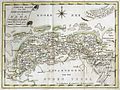
 Karte von Groningen und Ostfriesland.jpg 10,054 × 5,264; 17.99 MB
-
 Zeekaart van de Noordzee uit 1883.jpg 4,733 × 2,740; 3.61 MB
-
 Anglo.Saxon.homelands.250.450.jpg 2,045 × 2,600; 858 KB
-
 Blatt 35 Amrum Karte des Deutschen Reiches 100000.jpg 10,621 × 9,278; 11.71 MB
-
 Continental.coast.150AD.Germanic.peoples.jpg 2,033 × 2,193; 603 KB
-
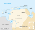
 Dep van de eems.jpg 640 × 480; 270 KB
-
 Habitate im Wattenmeer.png 1,015 × 882; 239 KB
-

-
 Hydrografische kaart — Noordzee. Monden van de Eems – 0817 03339-1 0001.jpg 12,858 × 11,393; 47.83 MB
-
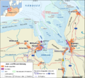 Jade-weser-muendung map de.png 800 × 743; 415 KB
-
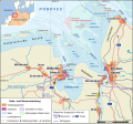 Jade-weser-muendung map de.svg 1,483 × 1,377; 617 KB
-
 Lange diercke sachsen deutsche landschaften wattenkueste.jpg 1,235 × 2,057; 1.14 MB
-
 Karte des Deutschen Reiches von 1893 (79) Eider-Mündung.jpg 10,686 × 9,323; 15.85 MB
-
 Morze Wattowe.png 489 × 435; 14 KB
-
 Ostfriesland es.svg 756 × 651; 349 KB
-
 Ostfriesland fr.svg 756 × 651; 349 KB
-
 PaysBas delisle 1743 fragment.jpg 2,666 × 2,042; 5.11 MB
-

-
 Topnl1820k002.jpg 3,360 × 2,640; 1.29 MB
-
 Vlie9.JPG 3,088 × 4,510; 668 KB
-
 Waddeneilanden.PNG 554 × 551; 14 KB
-
 Waddenzee1600.jpg 225 × 360; 33 KB
_43454.jpg)


_%E2%80%94_Noordzee._Friesche_zeegat_en_omliggende_Wadden_%E2%80%93_0817_03297-2_0001.jpg)


_Eider-M%C3%BCndung.jpg)


