Category:Maps of the Wadden Sea in the Netherlands
Media in category "Maps of the Wadden Sea in the Netherlands"
The following 6 files are in this category, out of 6 total.
-
 Natura2000 - Waddenzee.png 2,016 × 2,267; 1.17 MB
-
 Nederland NCP - Topografische kaarten - 30033499 - RCE.jpg 1,200 × 962; 131 KB
-
 Plan inpoldering Waddenzee (3381209883).jpg 6,918 × 8,577; 13.97 MB
-
 Waddenzee Noord-Holland Friesland Groningen OSM.png 1,640 × 833; 1.67 MB
-
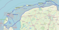
 West Frisian Islands Wikivoyage Map.png 5,000 × 2,680; 1.35 MB
-
 West Frisian Islands Wikivoyage Map.svg 2,380 × 1,276; 201 KB


.jpg)


