Category:Maps of the Western Bug
Media in category "Maps of the Western Bug"
The following 16 files are in this category, out of 16 total.
-
 Bieraście, Buh. Берасьце, Буг (1700-1830).jpg 10,652 × 12,659; 21.59 MB
-
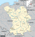
 Cours du Bug occ.png 426 × 392; 80 KB
-
 CuencaDelVístula.svg 656 × 685; 5.31 MB
-
 Flumina in limitem orientalem Poloniae.PNG 156 × 472; 7 KB
-
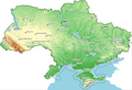
 Hydrographic zoning Ukraine.jpg 3,357 × 2,166; 3.12 MB
-
 Route of Bug River in Finnish.png 426 × 392; 90 KB
-
 Route of Bug River in German.png 888 × 820; 844 KB
-
 Schema Zachodniaha Buha.png 422 × 389; 86 KB
-
 The Vistula river basin in Ukraine border.png 832 × 569; 464 KB
-
 The Vistula river basin in Ukraine zoomed.png 570 × 655; 494 KB
-
 The Vistula river basin in Ukraine.png 834 × 570; 462 KB
-
 UkraineNWpripjat hu.svg 1,036 × 548; 287 KB
-
 UkraineNWpripjat.png 777 × 411; 219 KB
-
 Vistula river map hu.svg 1,333 × 1,440; 1.51 MB
-
 Vistula river map.png 1,000 × 1,080; 1.17 MB
-
 Карта Буг.JPG 3,264 × 2,448; 2.66 MB
.jpg)


