Category:Maps of the Yap Islands
Media in category "Maps of the Yap Islands"
The following 13 files are in this category, out of 13 total.
-

-
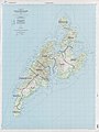
 Admiralty Chart No 1485 Yap Island, Published 1928, Corrections Copyright 1960.jpg 16,274 × 11,182; 46.81 MB
-
 Aéroport et routes (îles Yap).svg 1,157 × 1,530; 974 KB
-
 Journal des Museum Godeffroy BHL35399146.jpg 3,128 × 4,251; 1.02 MB
-
 Limites de mucinipalités (îles Yap).svg 1,157 × 1,530; 878 KB
-
 Nug (îles Yap).svg 1,157 × 1,530; 888 KB
-
 Tomil Bai detail, from- Journal des Museum Godeffroy BHL35399146 (cropped).jpg 1,689 × 1,278; 172 KB
-
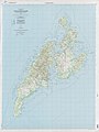 Txu-oclc-0607891424-yap island.jpg 3,756 × 5,000; 2.62 MB
-
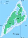
 Yap Islands municipalities.jpg 3,756 × 5,000; 3.15 MB
-
 Yap Islands-municipalities.png 533 × 615; 963 KB
-
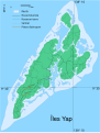
 Yap Islands.png 481 × 395; 51 KB
-
 Yapi saared.png 481 × 395; 65 KB
-
 Îles Yap.svg 1,157 × 1,530; 838 KB


.svg)

.svg)
.svg)
.jpg)


