Category:Maps of the ancient Levant
Subcategories
This category has the following 18 subcategories, out of 18 total.
A
B
- Maps of Levantine Bronze Age (33 F)
- Maps of the Byzantine Levant (66 F)
C
E
- Maps of Ebla (17 F)
- Maps of Edom (12 F)
H
I
K
N
- Maps of the Nabataeans (21 F)
P
- Maps of Philistia (67 F)
Q
- Maps of Qatna (13 F)
R
S
- Maps of Syro-Hittite states (16 F)
T
Media in category "Maps of the ancient Levant"
The following 52 files are in this category, out of 52 total.
-
360s Satrap Revolt.jpg 3,293 × 1,840; 546 KB
-
AlphabetSyroPalestine XIIIe-VIIIe Siecle.jpg 754 × 1,006; 161 KB
-
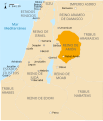
Amón 830-es.svg 605 × 706; 63 KB
-
Animated map of Alexander's route, c.334-325 BCE.gif 406 × 178; 8 KB
-
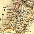
Antoine Philippe Houze . L'Empire des Perses. 1844 (E).jpg 1,381 × 1,324; 308 KB
-
Antoine Philippe Houze . L'Empire des Perses. 1844 (G).jpg 750 × 842; 116 KB
-
C+B-Moab-Map.JPG 1,194 × 1,873; 480 KB
-
C+B-Negeb-Map.JPG 1,049 × 1,484; 482 KB
-
C+B-Syria-Map1-AccordingToMonuments.JPG 689 × 2,047; 534 KB
-
C+B-Trachonitis-Map.JPG 1,215 × 1,489; 438 KB
-
Canaan (PSF).jpg 877 × 587; 76 KB
-
Deportationofjewsbyassyrian.jpg 600 × 423; 329 KB
-
DiffusionAlphabet XIIIe-VIIIe Siecle.jpg 754 × 1,006; 161 KB
-
Distribution of pottery Neolithic sites in southern Levant (temporary file).png 2,000 × 2,833; 491 KB
-
Distribution of pottery Neolithic sites in southern Levant-en.svg 1,984 × 2,952; 85 KB
-
Distribution of pottery Neolithic sites in southern Levant-fr.svg 1,984 × 2,952; 87 KB
-
Distribution of pottery Neolithic sites in southern Levant.png 1,710 × 2,612; 259 KB
-
Distribution of pottery Neolithic sites in southern Levant.svg 1,800 × 2,550; 46 KB
-
Edom 830-es.svg 605 × 706; 63 KB
-
Edom-Moab-830BCE.svg 720 × 859; 69 KB
-
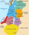
Kingdoms around Israel 830 map mk.svg 720 × 859; 177 KB
-
Kingdoms around Israel 830 map sh.svg 720 × 859; 62 KB
-
Kingdoms around Israel 830 map sr.svg 720 × 859; 62 KB
-
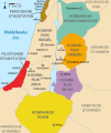
Kingdoms around Israel 830 map-de.png 1,004 × 1,198; 318 KB
-
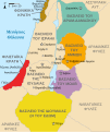
Kingdoms around Israel 830 map-el.svg 720 × 859; 509 KB
-
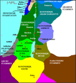
Kingdoms around Israel 830 map-nl.svg 720 × 859; 479 KB
-
Kingdoms around Israel 830 map.svg 720 × 859; 122 KB
-
Kingdoms of the Levant Map 830.xcf 1,955 × 2,332; 941 KB
-
Levant 830 nl 3-ar.png 720 × 855; 105 KB
-
Levant 830 nl 3.PNG 771 × 839; 153 KB
-
Levant1mil.JPG 574 × 788; 99 KB
-
Levante 830-es.svg 646 × 753; 262 KB
-
Map of Period 2A (Khiamian).jpg 533 × 685; 146 KB
-
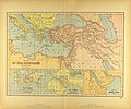
Map of the Ancient Near East.jpg 3,540 × 2,938; 2.34 MB
-
Mapa Palestyny w II i I tys p-n-e.svg 554 × 918; 988 KB
-
Middle East topographic map-blank 3000bc crop.svg 1,426 × 1,083; 10.01 MB
-
Moab 830-es.svg 605 × 706; 63 KB
-
Moabite territory map 1.jpg 297 × 409; 25 KB
-
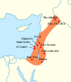
NatufianSpread-pt.svg 310 × 360; 37 KB
-
NatufianSpread.svg 310 × 360; 40 KB
-
Near East topographic map with toponyms 3000bc-pt.svg 1,426 × 1,083; 10.04 MB
-
Near East topographic map with toponyms 3000bc.svg 1,426 × 1,083; 10.04 MB
-
Ostjordanische Amoriterreiche.png 1,490 × 2,570; 397 KB
-
PelesetsCananeensPremiersIsraelites.jpg 547 × 620; 70 KB
-
Royaumes autour d'Israel en 830.svg 720 × 859; 99 KB
-
SASH D082 Map of classical syria.jpg 2,387 × 3,903; 972 KB
-
Sodgam.jpg 274 × 580; 34 KB


