Category:Maps of the canton of Bern to 2018
Media in category "Maps of the canton of Bern to 2018"
The following 25 files are in this category, out of 25 total.
-
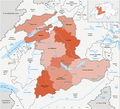
Karte Kanton Bern 2010.png 2,066 × 1,878; 1.27 MB
-
Karte Kanton Bern Verwaltungskreise 2010.png 2,066 × 1,878; 1.19 MB
-
Karte Kanton Bern Verwaltungsregionen 2010.png 2,066 × 1,878; 1.15 MB
-
Karte Kanton Bern Verwaltungskreise.png 1,476 × 1,344; 474 KB
-
Karte Kanton Bern Verwaltungskreis Bern-Mittelland.png 1,181 × 1,081; 300 KB
-
Karte Kanton Bern Verwaltungsregion Bern-Mittelland.png 1,181 × 1,080; 260 KB
-
Karte Kanton Bern Verwaltungskreis Berner Jura.png 1,181 × 1,081; 297 KB
-
Karte Kanton Bern Verwaltungsregion Berner Jura.png 1,181 × 1,080; 258 KB
-
Karte Kanton Bern Verwaltungskreis Biel Bienne.png 1,181 × 1,081; 292 KB
-
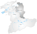
Karte Kanton Bern Verwaltungskreis Emmental.png 1,181 × 1,081; 300 KB
-
Karte Kanton Bern Verwaltungsregion Emmental-Oberaargau.png 1,181 × 1,080; 262 KB
-
Karte Kanton Bern Verwaltungskreis Frutigen-Niedersimmental.png 1,181 × 1,081; 299 KB
-
Karte Kanton Bern Verwaltungskreis Interlaken-Oberhasli.png 1,181 × 1,081; 301 KB
-
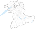
Karte Gemeinden des Kantons Bern 2017.png 2,952 × 2,448; 1.63 MB
-
Karte Gemeinden des Kantons Bern 2018.png 2,952 × 2,448; 1.63 MB
-
Karte Gemeinden des Kantons Bern farbig 2017.png 2,952 × 2,448; 1.99 MB
-
Karte Gemeinden des Kantons Bern farbig 2018.png 2,952 × 2,448; 1.98 MB
-
Karte Kanton Bern Bezirke 2009 clair.png 2,066 × 1,878; 898 KB
-
Karte Kanton Bern Verwaltungskreise 2010 clair.png 2,066 × 1,878; 873 KB
-
Karte Kanton Bern Verwaltungskreis Oberaargau.png 1,181 × 1,081; 296 KB
-
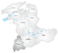
Karte Kanton Bern Verwaltungsregion Oberland.png 1,181 × 1,080; 268 KB
-
Karte Kanton Bern Verwaltungskreis Obersimmental-Saanen.png 1,181 × 1,081; 299 KB
-
Karte Kanton Bern Verwaltungskreis Seeland.png 1,181 × 1,081; 296 KB
-
Karte Kanton Bern Verwaltungsregion Seeland.png 1,181 × 1,080; 258 KB
-
Karte Kanton Bern Verwaltungskreis Thun.png 1,181 × 1,081; 295 KB


