Category:Maps of the canton of Fribourg
Cantons of Switzerland: Aargau (AG) · Appenzell Ausserrhoden (AR) · Appenzell Innerrhoden (AI) · Basel-Stadt (BS) · Basel-Landschaft (BL) · Bern (BE) · Fribourg (FR) · Geneva (GE) · Glarus (GL) · Graubünden (GR) · Jura (JU) · Luzern (LU) · Neuchâtel (NE) · Nidwalden (NW) · Obwalden (OW) · Schaffhausen (SH) · Schwyz (SZ) · Solothurn (SO) · St. Gallen (SG) · Thurgau (TG) · Ticino (TI) · Uri (UR) · Valais (VS) · Vaud (VD) · Zug (ZG) · Zürich (ZH)
Subcategories
This category has the following 53 subcategories, out of 53 total.
Media in category "Maps of the canton of Fribourg"
The following 24 files are in this category, out of 24 total.
-
 Karte Kanton Freiburg 2022.png 2,066 × 2,098; 822 KB
-
 Karte Kanton Freiburg Bezirke 2022.png 2,066 × 2,098; 745 KB
-
 1145 Bielersee.jpg 14,000 × 9,600; 83.9 MB
-
 1164 Neuchâtel.jpg 14,000 × 9,600; 70.87 MB
-
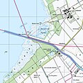
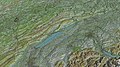
 1165 Murten.jpg 14,000 × 9,600; 74.94 MB
-
 1183 Grandson.jpg 14,000 × 9,600; 82.55 MB
-
 1184 Payerne.jpg 14,000 × 9,600; 70.9 MB
-
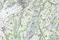
 1185 Fribourg.jpg 14,000 × 9,600; 96.22 MB
-
 1203 Yverdon-les-Bains.jpg 14,000 × 9,600; 84.74 MB
-
 1204 Romont.jpg 14,000 × 9,600; 89.19 MB
-
 1225 Gruyères.jpg 14,000 × 9,600; 129.81 MB
-
 1244 Châtel-St-Denis.jpg 14,000 × 9,600; 121.23 MB
-
 1245 Château-d'Œx.jpg 14,000 × 9,600; 124.57 MB
-
 Alte Landschaft (FR).png 1,312 × 1,224; 231 KB
-
 Bandeau FR part2.png 1,000 × 707; 148 KB
-
 ETH-BIB-Karte Gruyère, Pays d'Enhaut-Dia 247-Z-00371.tif 3,001 × 3,445; 29.71 MB
-
 Freiburg territoriale Entwicklung.jpg 1,500 × 1,091; 830 KB
-
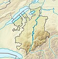 Fribourg relief location map.jpg 276 × 280; 115 KB
-
 Historische-Karte-des-Kantons-Freiburg-FR.png 2,000 × 1,454; 603 KB
-
 Historische-Karte-des-Kantons-Freiburg.png 2,000 × 1,454; 603 KB
-
-
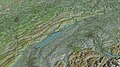 Neuchatel-TF-corrected.jpg 4,800 × 2,700; 5.77 MB
-
 Neuchatel-TF-uncorrected.jpg 4,800 × 2,700; 5.79 MB
-
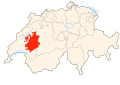 Switzerland Locator Map FR.svg 1,052 × 744; 213 KB


.png)


,_Neuenburg_(NW),_Waadt_(SW)_und_Fribourg_(SE)_-_(von_Swisstopo_Landeskarte_1165,_Raster_25).jpg)


