Category:Maps of the canton of Thurgau to 2010
Media in category "Maps of the canton of Thurgau to 2010"
The following 15 files are in this category, out of 15 total.
-
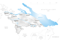
 Karte Kanton Thurgau 2010.png 2,066 × 1,391; 726 KB
-
 Karte Kanton Thurgau Bezirke 2010.png 1,476 × 993; 461 KB
-
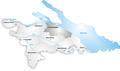
 Karte Kanton Thurgau.png 1,181 × 795; 167 KB
-
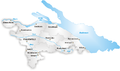
 Karte Kanton Thurgau Bezirke.png 1,181 × 795; 184 KB
-
 Karte Bezirk Arbon.png 1,181 × 694; 175 KB
-
 Karte Bezirk Bischofszell.png 1,181 × 694; 176 KB
-
 Karte Bezirk Diessenhofen.png 1,181 × 694; 173 KB
-
 Karte Bezirk Frauenfeld.png 1,181 × 694; 176 KB
-
 Karte Gemeinden des Kantons Thurgau 2000.png 2,952 × 1,786; 744 KB
-
 Karte Gemeinden des Kantons Thurgau farbig 2000.png 2,952 × 1,786; 880 KB
-
 Karte Bezirk Kreuzlingen.png 1,181 × 694; 176 KB
-
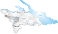
 Map of Canton Thurgau.png 885 × 520; 115 KB
-
 Karte Bezirk Münchwilen.png 1,181 × 694; 177 KB
-
 Karte Bezirk Steckborn.png 1,181 × 694; 177 KB
-
 Karte Bezirk Weinfelden.png 1,181 × 694; 176 KB


