Category:Maps of the history of Hamburg
Federal states of Germany:
Use the appropriate category for maps showing all or a large part of Hamburg. See subcategories for smaller areas:
| If the map shows | Category to use |
|---|---|
| Hamburg on a recently created map | Category:Maps of Hamburg or its subcategories |
| Hamburg on a map created more than 70 years ago | Category:Old maps of Hamburg or its subcategories |
| the history of Hamburg on a recently created map | Category:Maps of the history of Hamburg or its subcategories |
| the history of Hamburg on a map created more than 70 years ago | Category:Old maps of the history of Hamburg or its subcategories |
Subcategories
This category has the following 2 subcategories, out of 2 total.
M
O
Media in category "Maps of the history of Hamburg"
The following 35 files are in this category, out of 35 total.
-
Map-WR-Hamburg.svg 1,185 × 1,007; 542 KB
-
Hamburg in the German Reich (1925).svg 1,425 × 1,133; 967 KB
-
Map-DB-Hamburg.svg 1,793 × 1,571; 1.67 MB
-
Hamburg in the German Reich (1871).svg 1,425 × 1,133; 1,014 KB
-
Deutsches Reich (Karte) Hamburg.svg 650 × 545; 1.04 MB
-
Map-DR-Hamburg.svg 2,621 × 2,224; 712 KB
-
Hanse-Departments.png 2,362 × 1,709; 1.28 MB
-
Hamburg Sturmflut 1962.png 5,349 × 2,796; 15.36 MB
-
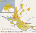
Map Hamburg Area 1500.png 854 × 792; 149 KB
-
Map Hamburg 1700.png 854 × 792; 204 KB
-
Map hamburg 1800.png 854 × 792; 390 KB
-
Barmbek1800.png 409 × 459; 19 KB
-
Hamburgerberg.png 659 × 223; 18 KB
-
Map hamburg fire 1842.png 854 × 792; 36 KB
-
Hamburg.png 1,363 × 1,188; 82 KB
-
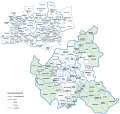
Pincerno - Groß-Hamburg 1.png 1,267 × 1,333; 28 KB
-
Pincerno - Groß-Hamburg 2.png 1,267 × 1,333; 49 KB
-
Verwaltungskarte Hamburg 1938.svg 1,349 × 1,279; 860 KB
-
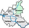
Hamburg-Stadtteilkarte-Wandsbek.jpg 600 × 569; 141 KB
-
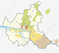
Ehemalige Bahnhöfe in Hamburg.svg 670 × 703; 196 KB
-
Old railway stations of Hamburg.svg 680 × 750; 4 KB
-
Cuxhaven.png 618 × 528; 215 KB
-
Groß-Hamburg.svg 512 × 489; 224 KB
-
Hamburg Gliederung 1875.svg 608 × 548; 250 KB
-
Hamburg Gliederung 1926.svg 608 × 548; 252 KB
-
Hamburger Landgebiet nach 1830.svg 608 × 548; 250 KB
-
Hamburger Landgebiet vor 1830.svg 608 × 548; 241 KB
-
Hammaburg 800.png 247 × 209; 63 KB
-
Hammaburg position.png 558 × 548; 580 KB
-
Karte der Sowjetrepublik Stormarn.svg 595 × 842; 152 KB
-
Karte Hep-Hep-Krawalle 1819.png 1,920 × 1,426; 1.2 MB
-
PPN742275035 Hamburg während der Belagerung von 1813 bis 1814 (1900).jpg 21,168 × 14,973; 53.98 MB
-
Wallhambg.jpeg 1,096 × 725; 714 KB
-
БСЭ1. Гамбург 1.jpg 1,933 × 1,401; 1.53 MB
-
БСЭ1. Гамбург 2.jpg 827 × 501; 232 KB


