Category:Maps of the history of Kharkiv Oblast
Subcategories
This category has the following 2 subcategories, out of 2 total.
G
M
- Maps of Kharkov Viceroyalty (4 F)
Media in category "Maps of the history of Kharkiv Oblast"
The following 5 files are in this category, out of 5 total.
-
 Map of Bilokolodezianskyi raion.png 1,487 × 1,481; 1.89 MB
-
 Map of Kharkiv okruga 1927.jpg 9,574 × 9,329; 20.57 MB
-
 Map of Starosaltivskyi raion.png 1,966 × 1,155; 2.04 MB
-
 U kartu Charkiv.jpg 2,480 × 1,860; 558 KB
-
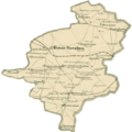
 Середній (Білоколодязький район).jpg 689 × 449; 161 KB


.jpg)