Category:Maps of the history of Kosovo under Ottoman Empire
Subcategories
This category has only the following subcategory.
O
Media in category "Maps of the history of Kosovo under Ottoman Empire"
The following 19 files are in this category, out of 19 total.
-
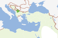
 Macedonia 1913 map.png 600 × 449; 60 KB
-
 Albanian vilayet.jpg 600 × 926; 329 KB
-
 Albanski vilajet.png 615 × 720; 48 KB
-
 Bosansko krajiste01.png 978 × 821; 57 KB
-
 Bosansko krajiste02.png 978 × 821; 59 KB
-
 Kosovo02-sr.png 770 × 845; 66 KB
-
 Kosovo02.png 770 × 845; 76 KB
-
 Kosovo03-sr.png 820 × 762; 65 KB
-
 Vilayet of Kosovo (1881–1912) map.png 820 × 762; 74 KB
-
 Kosovo Vilayet 1905.jpg 600 × 444; 166 KB
-
 League of Prizren.jpg 309 × 356; 53 KB
-
 Osmanu-vilajeti-kosova.svg 600 × 400; 228 KB
-
 Patriarchate of Peć in the 16th and 17th century.png 1,170 × 1,383; 129 KB
-
 Pecka patrijarsija mapa sr.png 1,170 × 1,383; 123 KB
-
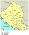
 Sanjak of Novibazar-es.svg 2,306 × 1,987; 242 KB
-
 Sanjak of Novibazar-sr.png 786 × 888; 61 KB
-
 Sanjak of Novibazar.png 786 × 888; 75 KB
-
 Serbia religion 16th 17th 01.png 638 × 1,077; 61 KB
-
 Serbia religion 16th 17th 02.png 638 × 1,077; 62 KB


_map.png)


