Category:Maps of the history of Ladakh
Media in category "Maps of the history of Ladakh"
The following 12 files are in this category, out of 12 total.
-

-
 Chagatai Khanate (1490).png 1,202 × 677; 792 KB
-
 Empire of King Nyimagon with three divisions about 975 .- 1000 CE.png 2,359 × 1,655; 794 KB
-
 Era of Fragmentation in Tibet.png 1,059 × 705; 1.21 MB
-
 Guge in Maryul.png 552 × 428; 529 KB
-
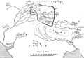
 Hung Ta-Chen's Map.jpg 545 × 666; 103 KB
-
 Map of Ming Chinese empire 1415.jpg 1,577 × 2,339; 451 KB
-

-
 Moghulistan.PNG 1,075 × 500; 995 KB
-
 The Empire of King Nyimagon with three divisions about 975 A. D.- 1000 A.D..jpg 1,726 × 1,189; 528 KB
-

-
 Western Regions 1st century BC(en).png 680 × 425; 646 KB

.png)


.jpg)


.png)