Category:Maps of the history of Marseille
Use the appropriate category for maps showing all or a large part of Marseille. See subcategories for smaller areas:
| If the map shows | Category to use |
|---|---|
| Marseille on a recently created map | Category:Maps of Marseille or its subcategories |
| Marseille on a map created more than 70 years ago | Category:Old maps of Marseille or its subcategories |
| the history of Marseille on a recently created map | Category:Maps of the history of Marseille or its subcategories |
| the history of Marseille on a map created more than 70 years ago | Category:Old maps of the history of Marseille or its subcategories |
Media in category "Maps of the history of Marseille"
The following 18 files are in this category, out of 18 total.
-
 Diocèse Marseille 1789.svg 2,000 × 1,922; 801 KB
-
 Marseille 8-10.png 837 × 726; 60 KB
-
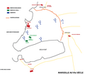
 Marseille au VIe siècle selon Marc Bouiron.png 1,150 × 626; 492 KB
-
 Marseille au VIIe siècle selon Marc Bouiron.png 1,150 × 585; 510 KB
-
 Marseille au XIIIe siècle SVG.svg 512 × 378; 198 KB
-
 Marseille au XIIIe siècle.png 1,175 × 726; 96 KB
-
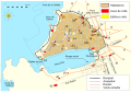
 Marseille aux viiie-xe s. selon Bouiron.png 1,150 × 586; 689 KB
-
 Marseille du VIIIe au Xe siècle selon Marc Bouillon SVG.svg 512 × 378; 3.68 MB
-
 MARSEILLE VIIIe siècle Bouiron.png 1,150 × 623; 500 KB
-
 Marseille-11.png 837 × 725; 66 KB
-
 Marseille-6.png 837 × 726; 53 KB
-
 Marseille-7.png 837 × 726; 57 KB
-
 Peste-marseille.svg 1,444 × 1,652; 554 KB
-
 Plan de Marseille au Moyen âge.svg 1,920 × 1,351; 563 KB
-
 Plano de Marsella en la edad media.svg 1,920 × 1,351; 564 KB
-
 Rivage antique du Vieux-Port de Marseille map-fr.svg 6,401 × 3,680; 449 KB
-
 Siege of Massilia 49 BC.jpg 1,754 × 1,104; 133 KB
-
 Tramway de Marseille PdM 2020-2030.svg 2,477 × 2,472; 248 KB


