Category:Maps of the history of Sumy Oblast
Media in category "Maps of the history of Sumy Oblast"
The following 7 files are in this category, out of 7 total.
-
 Ros Imp Kharkiv BilopilyePovit 1787.jpg 1,557 × 2,075; 288 KB
-
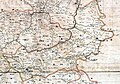
 Адміністративна карта Роменської округи УСРР 1925.jpg 3,192 × 3,096; 5.33 MB
-
 Белополье План 1787 года-2.jpg 1,768 × 2,314; 1.9 MB
-
 Белополье План 1787 года.jpg 1,779 × 2,309; 1.84 MB
-
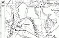
 Карта Белопольского уезда 18 век.jpg 2,442 × 3,147; 3.55 MB
-
 Комиші 1869.jpg 805 × 520; 185 KB
-
 Нежинский полк.jpg 5,387 × 3,761; 2.89 MB


