Category:Maps of the history of Tanzania
Countries of Africa: Algeria · Angola · Benin · Botswana · Burkina Faso · Burundi · Cameroon · Central African Republic · Chad · Democratic Republic of the Congo · Republic of the Congo · Djibouti · Egypt‡ · Equatorial Guinea · Eritrea · Eswatini · Ethiopia · Gabon · The Gambia · Ghana · Guinea · Guinea-Bissau · Ivory Coast · Kenya · Lesotho · Liberia · Libya · Madagascar · Malawi · Mali · Mauritania · Morocco · Mozambique · Namibia · Niger · Nigeria · Rwanda · Senegal · Sierra Leone · Somalia · South Africa · South Sudan · Sudan · Tanzania · Togo · Tunisia · Uganda · Zambia · Zimbabwe
Limited recognition: Ambazonia · Azawad · Somaliland – Other areas: Ceuta · Melilla · Réunion · Western Sahara
‡: partly located in Africa
Limited recognition: Ambazonia · Azawad · Somaliland – Other areas: Ceuta · Melilla · Réunion · Western Sahara
‡: partly located in Africa
Use the appropriate category for maps showing all or a large part of Tanzania. See subcategories for smaller areas:
| If the map shows | Category to use |
|---|---|
| Tanzania on a recently created map | Category:Maps of Tanzania or its subcategories |
| Tanzania on a map created more than 70 years ago | Category:Old maps of Tanzania or its subcategories |
| the history of Tanzania on a recently created map | Category:Maps of the history of Tanzania or its subcategories |
| the history of Tanzania on a map created more than 70 years ago | Category:Old maps of the history of Tanzania or its subcategories |
Subcategories
This category has the following 6 subcategories, out of 6 total.
Media in category "Maps of the history of Tanzania"
The following 9 files are in this category, out of 9 total.
-
 BurtonExploration-fr.png 804 × 486; 40 KB
-
 Carte du voyage the Stanley - How I found Livingstone (fr).png 2,532 × 1,500; 1.15 MB
-
 East African Federation (orthographic projection) proposed - 1963.png 1,024 × 1,024; 221 KB
-
 Great Lakes Kingdoms.png 592 × 523; 792 KB
-
 Karawanenrouten Ostafrika.jpg 1,228 × 1,032; 963 KB
-
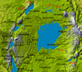
 Laetoli-Olduvai-Eyasi.jpg 4,420 × 4,420; 2.35 MB
-
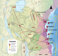
 Les expeditions de la Societe Internationale Africaine.png 835 × 646; 670 KB
-
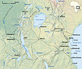
 Msiri's kingdom in 1880 760x460 lo-res.jpg 763 × 472; 89 KB
-
 Tanzania Portuguese 8.png 1,024 × 975; 884 KB

.png)
_proposed_-_1963.png)


