Category:Maps of the war of the Austrian Succession
Subcategories
This category has only the following subcategory.
Media in category "Maps of the war of the Austrian Succession"
The following 21 files are in this category, out of 21 total.
-

-
 An English version of the map drawn for the Universal Magazine, London, 1751.jpg 3,421 × 2,343; 1.48 MB
-
 Battle of Zahájí (maps by Georges-Louis Le Rouge, c. 1743).png 928 × 632; 838 KB
-
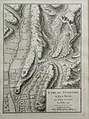
 Camp de l'Abbaye du Parc occupé par l'Armée du Roy, depuis le 24 juillet jusqu'au 1er aoust 1746.jpg 10,333 × 7,347; 11.12 MB
-
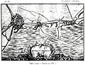
 Camp de St. Giacomo et la Neve, en avant de Final le 2 Juillet 1745.jpg 1,191 × 1,599; 454 KB
-
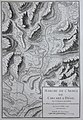
 Camp de Tagia le 6 Juin 1745.jpg 1,600 × 1,379; 342 KB
-

-
 Carte de Flandres - Bruxelles, Louvain, Aerschoot, Malines, Dendermonde, Lier.jpg 11,829 × 8,456; 10.71 MB
-
 Carte des opérations navales en 1747 dans l'Atlantique.jpg 1,353 × 900; 290 KB
-
 Carte des routes commerciales de la France vers les Antilles en 1745-1746.jpg 1,381 × 879; 327 KB
-
 Europe 1748-1766 blank.png 3,872 × 2,761; 855 KB
-
 Europe 1748-1766 en.png 3,872 × 2,761; 1.26 MB
-
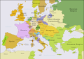
 Europe 1748-1766.png 3,872 × 2,761; 1.47 MB
-
-
 Siege of Landau in 1702.jpg 2,000 × 809; 942 KB
-

-
 WaroftheAustrianSuccession.png 1,357 × 628; 27 KB
-

-
 Карта к статье «Остенде». Военная энциклопедия Сытина (Санкт-Петербург, 1911-1915).jpg 4,025 × 3,283; 2.15 MB
-
-

.jpg)

.png)


_jusqu%27%C3%A0_la_fin_de_la_campagne.jpg)


.jpg)
.jpg)
.jpg)