Category:Maps of the world in the 18th century
Media in category "Maps of the world in the 18th century"
The following 8 files are in this category, out of 8 total.
-
 1700 CE world map.hu.png 4,500 × 2,234; 701 KB
-
 1700 CE world map.PNG 4,500 × 2,234; 364 KB
-
 BritishEmpire1776.png 1,425 × 625; 45 KB
-
 A.D. 1783. Independence Of The United States.jpg 3,244 × 2,575; 1.38 MB
-
 417 of 'Britain and her Rivals in the eighteenth century, 1713-1789' (11232034495).jpg 2,695 × 2,322; 977 KB
-
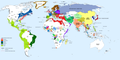
 Colonisation 1754.png 1,799 × 789; 144 KB
-
 Iberian Union empires.svg 940 × 415; 1.83 MB
-
 Neue Welt-Karte, 1784.jpg 7,956 × 6,498; 7.11 MB


.jpg)


