Category:Maps of tides
Subcategories
This category has only the following subcategory.
Media in category "Maps of tides"
The following 44 files are in this category, out of 44 total.
-
 245 of 'Elementary Physical Geography' (11238529254).jpg 1,429 × 2,102; 737 KB
-
 AdmoraltyvChart No 5059 Straits of Dover Co-tidal and Tidal Stream Chart, Published 1943.jpg 16,407 × 11,265; 45.28 MB
-
 Amfidromieen.JPG 300 × 346; 114 KB
-
 Amfidromieën.jpg 300 × 346; 608 KB
-
 Arctic tides (1911) (14760115061).jpg 4,016 × 3,348; 2.51 MB
-

-
-

-

-

-

-

-
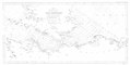
 Beechey Tidal Chart of the Irish Channel dated 1846.tiff 4,016 × 6,142; 1.56 MB
-
 Beechey Tide Chart of the English, Irish and Bristol Channels Ingoing dated 1848.tif 8,325 × 4,061; 1.65 MB
-
 Beechey Tide Chart of the English, Irish and Bristol Channels Outgoing dated 1848.tif 8,226 × 4,079; 1.65 MB
-
 Cotid mancheSodi.svg 573 × 518; 215 KB
-
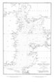
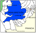
 Cotidal map tide round Great Britain Lubbock 1831 2.png 3,111 × 5,956; 7.2 MB
-
 Cotidal-lines-tide-height.jpg 600 × 403; 64 KB
-
 Cotidal-lines-world.jpg 1,269 × 759; 218 KB
-
 Diurnal tide types map.jpg 855 × 420; 125 KB
-
 Elementary physical geography (1907) (14585502127).jpg 1,498 × 2,386; 788 KB
-
 FMIB 43870 Co-tidal Lines of the British Isles.jpeg 913 × 1,274; 270 KB
-
 FMIB 43874 Tides of the English Channel.jpeg 891 × 555; 135 KB
-
 FMIB 43876 Course of the Tide in the Irish Sea.jpeg 883 × 985; 249 KB
-
Global surface elevation of M2 ocean tide.webm 31 s, 1,920 × 1,080; 5.77 MB
-
 Locais com marés superiores à 5 m de altura.jpg 559 × 315; 48 KB
-
 M2 tidal constituent.jpg 730 × 470; 122 KB
-
 M2 Tidal constituent.tif 6,142 × 3,567; 4.68 MB
-
 PSM V74 D535 Systems of semi daily tides around the world based on gmt.png 2,877 × 1,637; 1.2 MB
-
 PSM V74 D537 Cotidal lines of the atlantic ocean.png 2,016 × 3,226; 1,024 KB
-
 PSM V74 D538 Cotidal lines of the indian ocean.png 1,920 × 3,237; 823 KB
-
 PSM V74 D539 Cotidal lines of the pacific ocean.png 1,931 × 3,242; 991 KB
-
 PSM V74 D540 Cotidal lines for new york harbor and approaches.png 2,406 × 1,631; 342 KB
-
 The elements of astronomy; a textbook (1919) (14779879304).jpg 3,120 × 1,952; 1.16 MB
-
 Tide over 4 m.png 1,357 × 628; 64 KB
-
 Tides in Norway.png 1,225 × 2,510; 113 KB
-
 Whewell co-tidal chart 1.tif 2,537 × 3,856; 18.74 MB
-
 Whewell co-tidal chart 2.tif 3,840 × 4,905; 33.86 MB
-
 Whewell tidal chart Britain and Ireland 1836 amphidromic point southern North Sea.jpg 1,490 × 1,292; 487 KB
-
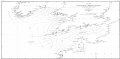
 Whewell tidal chart Britain and Ireland 1836.jpg 7,610 × 6,704; 4.4 MB
-
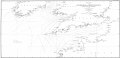
 Whewell tidal chart coasts of Europe 1836.jpg 3,189 × 5,430; 1.48 MB
-
 Whewell tidal chart Pacific 1848.jpg 3,872 × 3,396; 1.86 MB
-
 Whewell tidal chart World 1833 07023587 0090.jpg 23,281 × 10,627; 31.24 MB
-
 Whewell tidal height chart Britain and Ireland 1836.jpg 8,004 × 7,259; 4.11 MB
.jpg)


_(14760115061).jpg)


_(14585502127).jpg)


_(14779879304).jpg)


