Category:Maps of townlands in Ireland
Media in category "Maps of townlands in Ireland"
The following 10 files are in this category, out of 10 total.
-
 Aghavrin Townland.jpg 240 × 142; 26 KB
-
 Annotated map of the civil parish of Ballyvourney by townland.png 1,411 × 700; 395 KB
-
 Carhoo Lower.png 240 × 249; 30 KB
-
 Carhoo Upper image.png 240 × 200; 20 KB
-
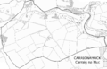 Carrignamuck townland.png 1,660 × 1,072; 638 KB
-
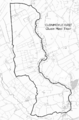 Clonmoyle East.png 622 × 948; 294 KB
-
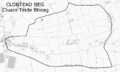 Clontead Beg.png 1,262 × 758; 158 KB
-
 KILKOO.png 646 × 524; 73 KB
-
 KILMEGAN.png 675 × 829; 82 KB
-
 Map of Drumgooland parish.png 630 × 583; 84 KB


