Category:Maps of weather and climate of Brazil
Subcategories
This category has the following 3 subcategories, out of 3 total.
I
- Insolation maps of Brazil (7 F)
K
Media in category "Maps of weather and climate of Brazil"
The following 24 files are in this category, out of 24 total.
-
 15 Dominios Moforclimaticos.jpg 1,579 × 1,600; 235 KB
-
 IMRAY(1884) p1007 Winds on the Coast of Brazil (1).jpg 717 × 949; 320 KB
-
 IMRAY(1884) p1007 Winds on the Coast of Brazil (2).jpg 699 × 931; 323 KB
-
 IMRAY(1884) p1007 Winds on the Coast of Brazil (3).jpg 731 × 965; 308 KB
-
 IMRAY(1884) p1007 Winds on the Coast of Brazil (4).jpg 713 × 949; 284 KB
-

-
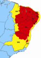
 2009-Brazil-Flood.png 1,397 × 1,761; 2.46 MB
-
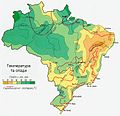 Brazil temp 1977 uk.jpg 771 × 745; 135 KB
-
 Brazil temp 1977.jpg 771 × 745; 157 KB
-
 Brazil veg 1977.jpg 799 × 758; 166 KB
-
 Classificação Climática Koppen de Rubim.jpg 4,133 × 4,527; 918 KB
-
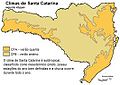 Clima santa catarina.jpg 266 × 189; 11 KB
-
 Climaserido.png 297 × 267; 26 KB
-
 ECDM 20240308 Brazil severe weather and floods.pdf 1,625 × 1,125; 565 KB
-

-
 Koppen-Geiger Map BRA future.svg 1,410 × 850; 2.14 MB
-
 Mapa-de-sao-paulo-ilhas-de-calor.jpg 896 × 509; 88 KB
-
 Mean-wind-speed-map-bahia-global-wind-atlas.pdf 2,479 × 1,752; 2.33 MB
-
 Mean-wind-speed-map-brazil-global-wind-atlas.png 3,308 × 2,339; 1.38 MB
-
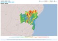
 Pluviometric Map of Bahia State (Bahia, 2003) (Adapted).jpg 481 × 518; 53 KB
-

-
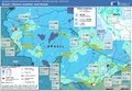
 Rainfall anomaly brazil april-may 2009.JPG 1,232 × 707; 168 KB
-
 Sertaonordestino.gif 149 × 211; 10 KB
-
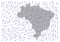 VentosBrasil.png 663 × 471; 105 KB

_p1007_Winds_on_the_Coast_of_Brazil_(1).jpg)
_p1007_Winds_on_the_Coast_of_Brazil_(2).jpg)
_p1007_Winds_on_the_Coast_of_Brazil_(3).jpg)
_p1007_Winds_on_the_Coast_of_Brazil_(4).jpg)


_(Adapted).jpg)


