Category:Maps of wetlands of Gard
Media in category "Maps of wetlands of Gard"
The following 5 files are in this category, out of 5 total.
-
 30341-Vauvert-Routes-Hydro.png 3,507 × 2,480; 4.68 MB
-
 30341-Vauvert-Sols.png 3,270 × 2,598; 3.74 MB
-
 30341-Vauvert-ZNIEFF1.png 4,692 × 3,307; 13.14 MB
-
 Carte topographique des marais de Peccais.jpg 838 × 640; 332 KB
-
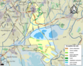
 Périmètre RNR Scamandre rnr88.png 1,294 × 817; 148 KB


