Category:Maps relating to the 2014 Israel–Gaza conflict
Media in category "Maps relating to the 2014 Israel–Gaza conflict"
The following 13 files are in this category, out of 13 total.
-
 Al.sheikh Ejleen 16.7.2014.jpg 1,325 × 669; 298 KB
-
 International reactions to Operation Protective Edge2.png 1,425 × 625; 38 KB
-
 Israeli Strikes on North Gaza.jpg 5,669 × 5,669; 5.89 MB
-
 Map-of-rockets-launches-from-gaza-from-2014-07-08-to-2014-07-31 2.jpg 424 × 526; 148 KB
-
 Map-of-rockets-launches-from-gaza-from-2014-07-08-to-2014-07-31.jpg 960 × 847; 165 KB
-
 Massacres 11.07.2014.jpg 1,199 × 673; 292 KB
-
 Massacres 12.07.2014.jpg 1,322 × 697; 349 KB
-
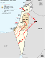 Rocket range of Hamas from Gaza, July 2014.svg 559 × 721; 166 KB
-
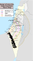
 Rockets from gaza (en).png 1,849 × 3,428; 925 KB
-
 Rockets from gaza (en-svg).svg 1,849 × 3,427; 247 KB
-
 Réactions internationales sur l'opération Bordure protectrice.png 1,425 × 625; 62 KB
-
 טווח ירי הרקטות מרצועת עזה.png 1,849 × 3,428; 917 KB
-
 טווח רקטות מרצועת עזה.svg 1,849 × 3,427; 248 KB


.png)
.svg)


