Category:Maps showing 1429
| 1422 1427 1429→ |
English: Maps showing the year 1429 (i.e. history maps)
See also category: 1429 maps. and 1420s maps for more maps showing this year usually created not long after the given year.
See also category: 1429 maps. and 1420s maps for more maps showing this year usually created not long after the given year.
Media in category "Maps showing 1429"
The following 6 files are in this category, out of 6 total.
-
 Carte de massiac en 1429.jpg 1,696 × 1,244; 373 KB
-
 English Possessions in France, 1180-1429.png 563 × 877; 1.28 MB
-
 France (1429)-fr-yug.svg 1,003 × 744; 1.4 MB
-
 França el 1429.png 872 × 639; 221 KB
-
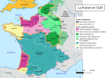
 La France en 1429-es.svg 856 × 894; 1.6 MB
-
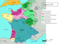
 La France en 1429.svg 1,024 × 744; 2 MB


-fr-yug.svg)


