Category:Maps showing 14th-century history
| Preceded by: 13th century maps |
14th century maps 1301 AD-1400 AD |
Succeeded by: 15th century maps |
Subcategories
This category has the following 17 subcategories, out of 17 total.
A
- Maps of 14th-century Arabia (2 F)
B
- Black Death migration (33 F)
E
F
T
- Maps of the Timurid Empire (106 F)
Media in category "Maps showing 14th-century history"
The following 62 files are in this category, out of 62 total.
-
 The Milanese under the Visconti.jpg 789 × 763; 372 KB
-
 1350 Mediterranean Sea.PNG 801 × 370; 135 KB
-
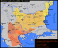
 488px-Bulgarian-Wallachian-Empire.jpg 488 × 427; 227 KB
-
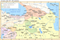
 Allgemeiner historischer Handatlas - Deutschland im 14. Jahrhundert.png 1,264 × 977; 3.16 MB
-
 Armenianmeds.gif 699 × 471; 56 KB
-
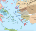 Aydin in 14 century.png 1,493 × 1,298; 687 KB
-
 Aydinid beylik area map-es.svg 1,817 × 1,514; 673 KB
-
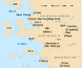 Aydinid beylik area map-pt.svg 1,817 × 1,514; 304 KB
-
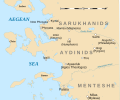 Aydinid beylik area map.svg 1,817 × 1,514; 496 KB
-
 Bahamani-sultanate-map.svg 1,521 × 1,761; 334 KB
-
 Balkans in 1350 according to Gustav Droysen from 19th century.jpg 1,367 × 1,268; 546 KB
-
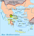
 BG 14 vek.png 888 × 729; 491 KB
-
 BG-ХІV.jpg 1,280 × 845; 260 KB
-
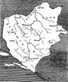 Bosnia during Ban Stefan Kotromanić, V. Ćorović.jpg 703 × 857; 184 KB
-
 Bosnia during King Tvrtko I, V. Ćorović.jpg 984 × 845; 196 KB
-
 Bulg & neighb. XIV A.png 730 × 599; 571 KB
-
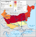
 Bulgaria Theodore Svetoslav.png 1,853 × 1,993; 2.24 MB
-
 Bulgaria-Theodore Svetoslav-es.svg 1,185 × 1,036; 1.09 MB
-
 Bulgaria-Theodore Svetoslav-fr.svg 3,280 × 2,473; 527 KB
-
 Bulgaria-Theodore Svetoslav-pt.svg 2,750 × 2,341; 582 KB
-
 Bulgaria-Theodore Svetoslav.png 1,853 × 1,993; 1.57 MB
-
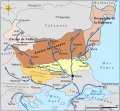
 Bulgaria1344-1396-es.png 582 × 599; 180 KB
-
 Bulgaria1344-1396-es.svg 677 × 625; 582 KB
-
 Bulgaria1344-1396-hu.svg 677 × 697; 229 KB
-
 Bulgaria1344-1396-pt.svg 677 × 697; 246 KB
-
 Bulgaria1344-1396.svg 677 × 697; 244 KB
-
 Bulgarian lands 1350 vek-hu.svg 892 × 731; 348 KB
-
 Caspian anarchy era.svg 1,067 × 699; 116 KB
-
 Chupanid - Jalayerid dynasty 1337–1432 ad-ar.png 620 × 428; 37 KB
-
 Chupanid - Jalayerid dynasty 1337–1432 ad.png 620 × 428; 23 KB
-
 Cilician Armenia-ar.svg 2,508 × 1,789; 848 KB
-
 Cilician Armenia-en.svg 2,508 × 1,789; 713 KB
-
 Cilician Armenia-es.svg 1,458 × 991; 1,001 KB
-
 Cilician Armenia-fr.svg 1,458 × 991; 374 KB
-
 Cilician Armenia-hu.svg 2,508 × 1,789; 642 KB
-
 Commerce-medieval-oran-fr.svg 709 × 354; 118 KB
-
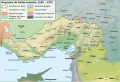
 Das Reich Timur-i Lenks (1365-1405).GIF 752 × 593; 18 KB
-
 DesmembramientoDelIljanato1337–1432(v2)-pt.svg 982 × 685; 267 KB
-
 DesmembramientoDelIljanato1337–1432.svg 1,801 × 1,373; 2.13 MB
-
 DespoDobro.png 250 × 432; 73 KB
-
 Domini Viscontei Sec. XIV.svg 567 × 567; 504 KB
-
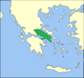 Ducado atenas.png 643 × 599; 72 KB
-
 Ducado neopatria-es.svg 638 × 675; 1.3 MB
-
 Ducado neopatria.png 328 × 351; 52 KB
-
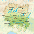
 Dutch Urban Centers in Holland.png 302 × 337; 60 KB
-
 Début guerre de cent ans-ja.svg 423 × 518; 65 KB
-
 Earlyrenaissancemap.jpg 654 × 600; 113 KB
-
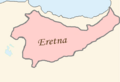 Eretnid domains.png 886 × 604; 30 KB
-
 Frankrijk 1350.svg 423 × 518; 189 KB
-
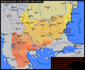
 Georgia during the reign of King George V.jpg 1,368 × 1,006; 173 KB
-
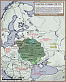 Grand Duchy of Lithuania Rus and Samogitia 1434.jpg 767 × 952; 433 KB
-
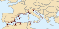
 Haupthandelsroute Hanse-ar.png 781 × 597; 176 KB
-
 Haupthandelsroute Hanse.png 789 × 603; 127 KB
-
 History of Russia, IX-XV c.jpg 2,538 × 3,277; 1.4 MB
-
 116IlkanidDomin1256-1335.gif 700 × 475; 57 KB
-
 Implantation des Bournonville en Boulonnais (v.1350-v.1500).svg 745 × 1,095; 98 KB
-
 Karte Böhmische Krone.png 823 × 821; 104 KB
-
 Kingdom of England.png 1,218 × 1,245; 20 KB
-
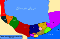
 Map shahrestan 1395 23.jpg 4,679 × 3,308; 2.39 MB
-
 Mid-14th c. Georgia map.svg 1,894 × 1,254; 661 KB
-
 The Barony of Cilician Armenia, 1080-1199.gif 699 × 472; 47 KB
-
 Vexilographic maps of Pontic littoral by end of 13th-17th century.svg 1,640 × 895; 2.58 MB


.GIF)
-pt.svg)


.svg)


