Category:Maps showing 17th-century BC history
| Preceded by: 18th century BC maps |
17th century BC maps 1700 BC-1601 BC |
Succeeded by: 16th century BC maps |
Subcategories
This category has only the following subcategory.
Media in category "Maps showing 17th-century BC history"
The following 8 files are in this category, out of 8 total.
-
 Alter Orient 1700BC-es.svg 2,102 × 1,510; 3.5 MB
-
 Alter Orient 1700BC.svg 2,102 × 1,510; 4.69 MB
-
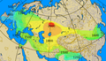
 Ancient Near East 1700BC.svg 2,102 × 1,510; 4.69 MB
-
 Chariot spread.png 400 × 231; 154 KB
-
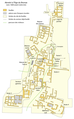 Map Akrotiri 1600 BC-fr.png 2,075 × 3,345; 635 KB
-
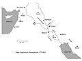 Map of Mesopotamia, 1770 BCE .jpg 2,042 × 1,506; 201 KB
-
 Minoan Ash.png 580 × 500; 423 KB
-
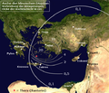
 Thera impact on Nile delta.gif 800 × 600; 47 KB


