Category:Maps showing 17th-century history
| Preceded by: 16th century maps |
17th century maps 1601 AD-1700 AD |
Succeeded by: 18th century maps |
Subcategories
This category has the following 24 subcategories, out of 24 total.
.
- 17th-century solar eclipse maps (88 F)
1
A
- Maps of 17th-century Arabia (7 F)
E
M
- Maps of New Sweden (29 F)
- Maps of the Anglo-Dutch wars (12 F)
O
S
Media in category "Maps showing 17th-century history"
The following 136 files are in this category, out of 136 total.
-
 Merian Weißenfels 1641.jpg 800 × 517; 130 KB
-
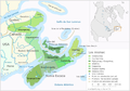
 1650Azie.jpg 914 × 709; 48 KB
-
 6. Sverige erobrer Ingria og Kexholm i 1617 og Letland i 1629.png 2,000 × 2,541; 617 KB
-
 Acquisitions in the Reign of Louis XIV.png 928 × 846; 660 KB
-
 Alonso de Pineda-mapa ekspedycji.png 751 × 513; 95 KB
-
 AngloDutchWarGer3.png 2,245 × 1,607; 392 KB
-
 Annecy XVII.jpg 3,619 × 2,557; 1.45 MB
-
 Battle of Bantry Bay,11 May 1689-en.svg 974 × 640; 48 KB
-
 Battle of Bantry Bay,11 May 1689-es.svg 974 × 640; 263 KB
-
 Battle of Bantry Bay,11 May 1689-fr.svg 974 × 640; 48 KB
-
 Battle of Bantry Bay,11 May 1689-hu.svg 974 × 640; 48 KB
-
 Battle of Beachy Head (1690)-en.svg 1,036 × 711; 34 KB
-
 Battle of Beachy Head (1690)-es.svg 1,036 × 711; 33 KB
-
 Battle of Beachy Head (1690)-fr.svg 1,036 × 711; 34 KB
-
 Battle of Beachy Head (1690)-hu.svg 1,036 × 711; 34 KB
-
 Battle of Walcourt 1689.png 456 × 433; 26 KB
-
 BNE.Barcelona.planos.1698.jpg 3,284 × 1,231; 2.1 MB
-
 Buryatia - russian ostrog.svg 1,359 × 915; 171 KB
-
 Cape Cod 1620.svg 351 × 384; 24 KB
-
 Carte de Haute-Alsace, Basse-Alsace et Palatinat du Rhin.jpg 20,570 × 5,385; 22.82 MB
-
 Catalonia1687-1697.png 696 × 498; 70 KB
-
 Crimea blank.svg 450 × 371; 467 KB
-
 Curonians kursenieki in 1649.png 400 × 400; 6 KB
-
 Dauria and Amur region 1650-55 cz.svg 1,985 × 1,281; 162 KB
-
 Dauria and Amur region 1652-58 cz.svg 1,985 × 1,281; 213 KB
-
 Dauria and Amur region 1683-84 cz.svg 1,985 × 1,281; 200 KB
-
 Dauria and Amur region 1686-88 cz.svg 1,985 × 1,281; 189 KB
-
 Dauria and Amur region 1689 cz.svg 1,985 × 1,281; 174 KB
-
 De Mi'kmaq.png 2,360 × 1,650; 996 KB
-
 DerdeEngelsNederlandseoorlog.png 345 × 262; 9 KB
-

-
 Descrição de todo o Estado do Brasil.jpg 766 × 1,024; 678 KB
-
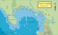 Dutch Landing, Galle - 1640.png 3,296 × 1,970; 693 KB
-
 DutchPortugueseWar1661.png 1,357 × 628; 32 KB
-
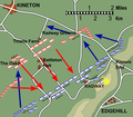 Edgehill2.png 541 × 475; 136 KB
-
 Els Micmac.png 2,360 × 1,650; 985 KB
-
 Empire Autricien au XVIII. siecle.jpg 2,880 × 2,139; 1.69 MB
-
 Erlangen Grundriss vor 1686 001.JPG 1,000 × 1,086; 422 KB
-
 Europa 17 u. 18 Jh.jpg 5,536 × 4,336; 10.3 MB
-
 Europa w XVII wieku (Ultima Thule).png 748 × 569; 925 KB
-
 Fotothek df tg 0002917 Architektur ^ Festungsbau ^ Approche.jpg 635 × 820; 254 KB
-
 Fürstbistum Speyer.png 420 × 280; 139 KB
-
 Giacomo Cantelli da Vignola - Marchesato et Elettorato di Brandebvrg (1687).jpg 4,457 × 3,438; 7.83 MB
-
 Giurisdizioni bresciane in epoca veneta (Luca Giarelli).png 1,367 × 2,000; 273 KB
-
 History of Russia, 1598-1682.jpg 1,320 × 1,641; 603 KB
-
 History of Russia, XVI-XVII c.jpg 2,730 × 1,756; 1.17 MB
-
 Holy Roman Empire c. 1700.png 1,281 × 796; 635 KB
-
 I Mi'kmaq.png 2,360 × 1,650; 1,002 KB
-
 Iberian Union Empires.png 1,357 × 628; 25 KB
-
 ImperioOtomanoSimplificado-ar.svg 912 × 750; 901 KB
-
 ImperioOtomanoSimplificado-pt.svg 912 × 750; 753 KB
-
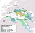
 ImperioOtomanoSimplificado.svg 912 × 750; 2.27 MB
-
 JapaneseTrade17thCentury.jpg 441 × 600; 158 KB
-
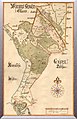
 John Speed, map of Ireland.jpg 3,456 × 2,592; 5.92 MB
-
 K0nigl+herzoglPreussen-2009-25-12.png 1,924 × 1,423; 983 KB
-
 K0nigl+herzoglPreussen.png 1,036 × 756; 42 KB
-
 Les Micmacs.png 2,360 × 1,650; 1,007 KB
-
 Loango-Angolakust.jpg 392 × 532; 30 KB
-
 Location of Cossack Hetmanate.png 964 × 750; 1.68 MB
-
 LocationSwedishEmpire.png 1,200 × 1,000; 29 KB
-
 Los Micmac.png 2,360 × 1,650; 996 KB
-
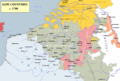 Low Countries 1700.png 1,520 × 1,028; 582 KB
-
 Map of Poland and Lithuania in 1600-es.svg 843 × 638; 129 KB
-
 Map of Poland and Lithuania in 1600.svg 845 × 639; 48 KB
-
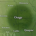 Map of Traditional Osage Tribal Lands by Late 17th Century.jpg 400 × 400; 43 KB
-
 Maratha Empire 1680.PNG 500 × 590; 48 KB
-
 Martini travels.svg 892 × 604; 1.77 MB
-
 Mascouten01.png 1,366 × 1,140; 2.31 MB
-
 Mataram Sultanate in Sultan Agung Reign id.svg 1,026 × 379; 321 KB
-
 Miiduranna (Maito Strand) kaart 1689 a.jpg 768 × 1,191; 195 KB
-
 Mikmaq-Stammesgebiet.png 2,360 × 1,650; 1,001 KB
-
 Battle of Neerwinden (1693).jpg 795 × 583; 125 KB
-
 Nieuw Nederland.png 586 × 750; 110 KB
-
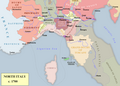 North Italy 1700.png 1,137 × 815; 308 KB
-
 Nova kurona lingvo dum 1649.png 400 × 400; 51 KB
-
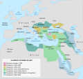
 OttomanEmpireIn1683 ar.png 1,966 × 1,850; 379 KB
-
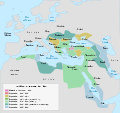
 OttomanEmpireIn1683-es.svg 1,966 × 1,850; 835 KB
-
 OttomanEmpireIn1683-fr.svg 1,966 × 1,850; 302 KB
-
 OttomanEmpireIn1683-he.png 1,966 × 1,669; 229 KB
-
 OttomanEmpireIn1683-pt.svg 1,966 × 1,850; 240 KB
-
 OttomanEmpireIn1683-ru.png 1,966 × 1,850; 356 KB
-
 OttomanEmpireIn1683-zh-hans.svg 1,966 × 1,850; 1.88 MB
-

-
 Plaza de Mayo 1619.JPG 800 × 600; 31 KB
-
 Poamuří kolonizace.svg 1,354 × 779; 174 KB
-
 Polish Lithuanian Ruthenian Commonwealth 1658 historical map.jpg 747 × 932; 496 KB
-
 PolskaWazów.gif 468 × 401; 14 KB
-
 PolskaXVIIwieku.gif 355 × 353; 9 KB
-
 Proportions.png 629 × 511; 35 KB
-
 ProvOttomanEmpire1609.png 768 × 600; 283 KB
-
 Pukina Map.png 1,614 × 888; 1.42 MB
-
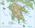 Regno di Morea de.svg 1,785 × 1,398; 1.12 MB
-
 Regno di Morea.svg 1,785 × 1,398; 1.73 MB
-
 Regno di MoreaV1Make.svg 6,479 × 5,113; 2.05 MB
-
 Resized-inu-afrmap-3826231-recto-master.png 3,606 × 3,007; 19.99 MB
-
 Resized-inu-afrmap-3826232-recto-master.png 3,519 × 3,069; 19.99 MB
-
 Resized-inu-afrmap-3826233-recto-master.png 3,520 × 3,106; 20 MB
-
 Resized-inu-afrmap-3991863-recto-master.png 4,122 × 2,764; 19.99 MB
-
 Revolta de les Barretines i Guerra dels Nou Anys (ca).jpg 7,362 × 5,400; 1.64 MB
-
 Revolta de les Barretines i Guerra dels Nou Anys (en).jpg 7,383 × 5,400; 1.64 MB
-
 Rhine campaign 1688-89.png 758 × 624; 162 KB
-
 RyeHouseLocationMap.svg 1,160 × 2,705; 2.31 MB
-
 RyeHousePlot1683.svg 1,160 × 2,705; 2.65 MB
-
 J.D. Schleuen - General Carte der gesammten Königlichen Preussischen Länder (1750).jpg 5,614 × 4,635; 16.14 MB
-
 Setge de Barcelona de 1651.jpg 450 × 190; 117 KB
-
 Setge de Barcelona de 1652.jpg 680 × 480; 124 KB
-
 Señorio de las 5 Villas.jpg 414 × 430; 70 KB
-
 Sino-russian border after treaty of Nerchinsk.svg 1,985 × 1,281; 196 KB
-
 Sino-Russian border conflicts cz.svg 1,985 × 1,281; 222 KB
-
 Sino-Russian border conflicts es.svg 1,985 × 1,281; 395 KB
-
 Siège de Barcelone.jpg 597 × 455; 44 KB
-
 Slavenkustwic.jpg 393 × 405; 25 KB
-
 SquantoTravels.jpg 1,134 × 635; 303 KB
-
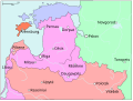
 Stary Dzedzin 17th Century be.png 1,210 × 910; 71 KB
-
 Stary Dzedzin 17th Century de.png 1,210 × 910; 113 KB
-
 Stary Dzedzin 17th Century en.png 1,210 × 910; 66 KB
-
 Stary Dzedzin 17th Century ru.png 1,210 × 910; 72 KB
-
 The Administrative Divisions of Safavid Iran in the the South Caucasus.svg 2,646 × 2,540; 9.24 MB
-
 The Mi'kmaq raw version.png 2,360 × 1,650; 772 KB
-
 The Mi'kmaq.png 2,360 × 1,650; 985 KB
-
 Vanersborg1676.jpg 2,480 × 1,660; 396 KB
-

-
 Verdelingsplannen Zuidelijke Nederlanden 17e eeuw.PNG 403 × 316; 139 KB
-
 Vexilographic maps of Pontic littoral by end of 13th-17th century.svg 1,640 × 895; 2.58 MB
-
 Viagem do Japao.png 1,021 × 656; 701 KB
-
 Vlie9.JPG 3,088 × 4,510; 668 KB
-
 VOCBirma.jpg 545 × 525; 59 KB
-
 Wielki Gościniec Litewski.png 1,347 × 1,218; 392 KB
-
 World Map 1689-smaller.jpg 2,280 × 1,968; 1.01 MB
-
 Wpdms province of maine 1622.png 347 × 393; 73 KB
-
 Zaydi State 1675.jpg 1,660 × 1,100; 1.25 MB
-
 Zeelandia taiwan 17century.gif 704 × 534; 41 KB
-
 Zeelandia-environs.png 304 × 279; 11 KB
-
 ZLB-Berliner Ansichten-Januar.jpg 4,961 × 3,390; 3.23 MB
-
 Électorat de Mayence.png 500 × 641; 57 KB
-
 Русско-турецкая война 1668-1670.jpg 532 × 576; 136 KB


-en.svg)
-es.svg)
-fr.svg)
-hu.svg)


.png)


.jpg)
.png)


_kaart_1689_a.jpg)

.jpg)


.jpg)
.jpg)


.jpg)


