Category:Maps showing 1849
| ← 1840 1841 1842 1843 1844 1845 1846 1847 1848 1849→ |
English: Maps showing the year 1849 (i.e. history maps)
See also category: 1849 maps. and 1840s maps for more maps showing this year usually created not long after the given year.
See also category: 1849 maps. and 1840s maps for more maps showing this year usually created not long after the given year.
Media in category "Maps showing 1849"
The following 7 files are in this category, out of 7 total.
-
 1849 Wisconsin gubernatorial election results map by county.svg 454 × 489; 37 KB
-
 1849-cu il kamerlakadan.png 5,644 × 5,106; 734 KB
-
 Karl von Urban - campaign Transylvania Summer 49.png 1,356 × 1,328; 1.65 MB
-
 Map of England showing prevalence of cholera, 1849 Wellcome L0039174.jpg 3,760 × 4,653; 9.8 MB
-
 Multan fort.png 600 × 391; 284 KB
-
 United States 1849-1850.png 1,000 × 677; 95 KB
-
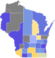
 WI Assembly Partisan Map 1849.svg 245 × 262; 48 KB


