Category:Maps showing 6th-century history
| Preceded by: 5th century maps |
6th century maps 501 AD-600 AD |
Succeeded by: 7th century maps |
Subcategories
This category has the following 9 subcategories, out of 9 total.
- Maps showing the 500s (3 F)
- Maps showing the 530s (1 F)
- Maps showing the 550s (16 F)
- Maps showing the 580s (5 F)
A
- Maps of 6th-century Arabia (10 F)
M
Media in category "Maps showing 6th-century history"
The following 51 files are in this category, out of 51 total.
-
 1800 Wilkinson Map of the 4 Eastern Churches rectified.jpg 1,678 × 1,308; 895 KB
-
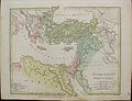 1800 Wilkinson Map of the 4 Eastern Churches.jpg 1,802 × 1,378; 1.95 MB
-
 526 Europe.png 500 × 337; 46 KB
-
 Alodia 565ad.jpg 998 × 619; 233 KB
-
 Alter Orient 0600AD-es.svg 2,102 × 1,510; 3.55 MB
-
 Alter Orient 0600AD.svg 2,102 × 1,510; 4.71 MB
-
 Anglo saxon jute 575ad.jpg 960 × 720; 74 KB
-
 Area at the time of Justinian I's death in the Byzantine Empire.png 2,500 × 1,431; 519 KB
-
 Arranshahiks en.jpg 1,848 × 1,291; 384 KB
-
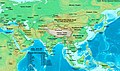 Asia 500ad.jpg 2,196 × 1,305; 435 KB
-
 Asia 565ad.jpg 2,379 × 1,291; 448 KB
-
 Blemmyes map.jpg 605 × 605; 163 KB
-
 Eastern Europe, VI-VII centuries.png 2,352 × 1,667; 721 KB
-
 Empire of the Kökturks.png 1,745 × 1,088; 2.56 MB
-
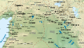
 ERE SPE in 570AD.jpg 1,763 × 943; 708 KB
-
 Exarchates 560.png 1,590 × 871; 315 KB
-
 First Turk Khaganate(600).PNG 752 × 590; 31 KB
-
 Karta-srbije.jpg 800 × 445; 81 KB
-
 Kavad's campaigns-pt.svg 512 × 329; 58 KB
-
 Khosraw I's campaigns-es.svg 3,108 × 2,000; 828 KB
-
 Khosraw I's campaigns-pt.svg 512 × 329; 61 KB
-
 Khosraw II's and Heraclius' campaigns-es.svg 3,108 × 2,000; 814 KB
-
 Khosraw II's and Heraclius' campaigns-pt.svg 512 × 329; 64 KB
-
 Lingue impero bizantino 565.JPG 906 × 409; 86 KB
-
 LocationByzantineEmpire.png 1,084 × 705; 29 KB
-
 LocationByzantineEmpire.svg 1,084 × 705; 181 KB
-
 Map of Persian Military-pt.svg 512 × 329; 290 KB
-
 Map of the middle east in 575 AD.png 1,116 × 541; 63 KB
-
 Mapa gótských válek cz.gif 1,133 × 1,240; 347 KB
-
 More complete map of Eastern Europe peoples VI-VII cent.png 2,352 × 1,667; 719 KB
-
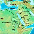
 N-Mesopotamia and Syria-ar.svg 2,185 × 1,254; 11 MB
-
 N-Mesopotamia and Syria.svg 2,185 × 1,254; 10.99 MB
-
 NE 565ad.jpg 1,477 × 973; 226 KB
-
 Pueblos eslavos siglo VI mapa historico.jpg 767 × 952; 403 KB
-
 Roman Empire 600 AD.PNG 694 × 396; 13 KB
-
 Roman-Persian Frontier in Late Antiquity-ar.svg 2,727 × 1,804; 1.72 MB
-
 Roman-Persian Frontier in Late Antiquity-es.svg 2,727 × 1,804; 4.55 MB
-
 Roman-Persian Frontier in Late Antiquity-fr.svg 2,727 × 1,804; 849 KB
-
 Roman-Persian Frontier in Late Antiquity-hu.svg 2,727 × 1,804; 3.2 MB
-
 Roman-Persian Frontier in Late Antiquity-pt.svg 2,727 × 1,804; 830 KB
-
 Roman-Persian Frontier in Late Antiquity-ru.svg 2,718 × 1,743; 1.61 MB
-
 Roman-Persian Frontier in Late Antiquity-zh.svg 2,710 × 1,740; 1.58 MB
-
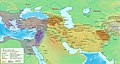
 Roman-Persian Frontier in Late Antiquity.svg 2,710 × 1,740; 2 MB
-
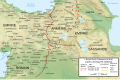
 Roman-Persian Frontier, 565 AD-es.svg 512 × 460; 1.57 MB
-
 Roman-Persian Frontier, 565 AD-pt.svg 512 × 460; 83 KB
-
 Roman-Persian Frontier, 565 AD-zh.svg 1,875 × 1,685; 344 KB
-
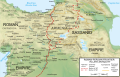
 Roman-Persian Frontier, 565 AD.png 838 × 775; 1.86 MB
-
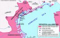 The Venetia c 600 AD.jpg 6,145 × 3,952; 3.01 MB
-
 Ziemiopis - Drezno i okolice w V-VI wieku.png 7,500 × 5,000; 1.86 MB
-
 Հայաստանը վաղ միջնադարում.svg 2,710 × 1,740; 830 KB
-
 北魏・斉.PNG 757 × 606; 32 KB


.PNG)


