Category:Maps showing the 450s
Media in category "Maps showing the 450s"
The following 9 files are in this category, out of 9 total.
-
 AD 0455 Greatest extent of the Vandal Kingdom ca.svg 1,897 × 896; 220 KB
-
 AD 0455 Greatest extent of the Vandal Kingdom DA.svg 1,897 × 896; 214 KB
-
 AD 0455 Greatest extent of the Vandal Kingdom EN.svg 1,897 × 896; 213 KB
-
 AD 0455 Greatest extent of the Vandal Kingdom es.svg 1,897 × 896; 236 KB
-
 AD 0455 Greatest extent of the Vandal Kingdom pt.svg 1,897 × 896; 216 KB
-
 Battle of Avarayr.gif 700 × 493; 33 KB
-
 Chalkedónmapa.svg 512 × 337; 23.34 MB
-
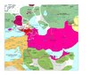 Moyen-Orient en 450.pdf 1,752 × 1,239; 430 KB
-
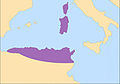 Vandals 455.jpg 1,575 × 1,104; 205 KB


