Category:Maps violating territorial integrity of Kosovo
Media in category "Maps violating territorial integrity of Kosovo"
The following 24 files are in this category, out of 24 total.
-
 Central balkan pol98.jpg 1,114 × 1,396; 282 KB
-
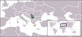
 Europe location map of Serbia with Kosovo marked.png 1,600 × 1,200; 110 KB
-
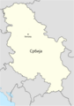
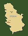
 Gradovi Srbije dopuna.png 536 × 776; 271 KB
-
 Kosovo and Serbia with proposed land swap.png 400 × 565; 7 KB
-
 Kosovo location map within Serbia (2006–2008).png 250 × 115; 5 KB
-
 Kosovo Presevo location map.png 800 × 1,056; 181 KB
-
 Location Map of FCA Serbia.jpg 800 × 1,016; 113 KB
-
 Location map of Serbia (2006–2008).png 250 × 115; 6 KB
-
 Location map of Serbia in Europe (2006–2008).gif 1,280 × 1,024; 87 KB
-
 Location map of Serbia in Europe (2006–2008).png 645 × 690; 142 KB
-
-
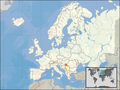
 Location map of the Republic of Serbia in Europe (2006–2008).png 800 × 600; 260 KB
-
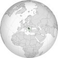
 Location of Serbia (globe).svg 572 × 572; 346 KB
-
 Location Serbia Europe Kosovo Semi-Included.png 2,056 × 1,800; 545 KB
-
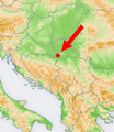 Map of Bermet in Serbia (2006–2008).png 251 × 289; 107 KB
-
 Map of Europe and Serbia (2006–2008).svg 2,045 × 1,720; 7.39 MB
-
 Map of Kosovo in Serbia (2006–2008).jpg 328 × 840; 50 KB
-
 Map of Serbia after proposed partition of northern Kosovo.png 1,200 × 1,718; 233 KB
-
 Map of Serbia in Europe (2006–2008).png 1,231 × 929; 41 KB
-
 Map of the Republic of Serbia (2006–2008).svg 680 × 520; 597 KB
-
 Map of Zlatibor in Serbia (2006–2008).jpg 458 × 590; 25 KB
-
 OCHA location map of Serbia in 2013.jpg 1,058 × 1,167; 105 KB
-
 Orthographic projection map of Serbia (2006–2008).png 1,106 × 1,106; 487 KB
-
 Serbia - Location Map (2013) - SRB - UNOCHA.svg 250 × 250; 924 KB


.png)


.png)
.gif)
.png)
.png)
.png)
.svg)

.png)
.svg)

.png)
.svg)
.jpg)

.png)
_-_SRB_-_UNOCHA.svg)
.svg)
.jpg)