Category:Marbletown, New York
town in Ulster County, New York, United States  | |||||
| Upload media | |||||
| Instance of | |||||
|---|---|---|---|---|---|
| Location | Ulster County, New York | ||||
| Inception |
| ||||
| Population |
| ||||
| Area |
| ||||
| Elevation above sea level |
| ||||
 | |||||
Images or other media of or otherwise pertinent to the town of Marbletown, NY, USA, including the hamlets of Stone Ridge and High Falls.

Subcategories
This category has the following 3 subcategories, out of 3 total.
H
P
S
Media in category "Marbletown, New York"
The following 31 files are in this category, out of 31 total.
-
 Beers Ulster County Atlas Page081.jpg 1,257 × 1,000; 193 KB
-
 Beers Ulster County Atlas Page082-083.jpg 1,000 × 1,544; 304 KB
-
 Beers Ulster County Atlas Page084.jpg 1,000 × 1,257; 173 KB
-
 ColonialChurch.jpg 3,264 × 2,448; 3.3 MB
-
 DavisTavern.jpg 3,264 × 1,836; 1.83 MB
-
 Esopus Creek at Marbletown, NY, town park 2.jpg 7,360 × 4,912; 25.11 MB
-
 Esopus Creek at Marbletown, NY, town park.jpg 3,204 × 2,400; 6.58 MB
-
 Esopus Creek from Hurley Mountain Road bridge, Lomontville, NY.jpg 2,694 × 2,094; 5.02 MB
-
 Frozen lake - panoramio (2).jpg 3,264 × 2,448; 1.86 MB
-
 GristMill1762.jpg 3,264 × 1,836; 1.12 MB
-
 KripChurch.jpg 3,264 × 1,836; 2.42 MB
-
 KripGenStore.jpg 3,264 × 1,836; 2.76 MB
-
 KripSchoolHouse.jpg 3,264 × 1,836; 1.71 MB
-

-

-

-
-

-

-

-

-

-

-
-

-

-

-
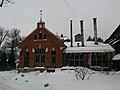
 Power station - panoramio (2).jpg 3,264 × 2,448; 1.59 MB
-
 Power station - panoramio (3).jpg 3,264 × 2,448; 1.67 MB
-
 Road - panoramio (196).jpg 3,264 × 2,448; 2.63 MB
-


.jpg)


.jpg)
.jpg)
.jpg)