Category:Marcardsmoor
| Object location | | View all coordinates using: OpenStreetMap |
|---|
human settlement in Germany | |||||
| Upload media | |||||
| Instance of |
| ||||
|---|---|---|---|---|---|
| Location | Wiesmoor, Aurich, Lower Saxony, Germany | ||||
| Elevation above sea level |
| ||||
 | |||||
Subcategories
This category has the following 3 subcategories, out of 3 total.
Media in category "Marcardsmoor"
The following 2 files are in this category, out of 2 total.
-
 Blick in Richtung Ems-Jade-Kanal.jpg 4,000 × 2,250; 3.76 MB
-
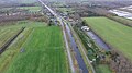 Marcardsmoorkanal.jpg 4,000 × 2,250; 3.52 MB

