Category:March 2007 in Gloucestershire
Ceremonial counties of England: Bedfordshire · Berkshire · Buckinghamshire · Cambridgeshire · Cheshire · Cornwall · Cumbria · Derbyshire · Devon · Dorset · Durham · East Riding of Yorkshire · East Sussex · Essex · Gloucestershire · Greater London · Greater Manchester · Hampshire · Herefordshire · Hertfordshire · Isle of Wight · Kent · Lancashire · Leicestershire · Lincolnshire · Merseyside · Norfolk · North Yorkshire · Northamptonshire · Northumberland · Nottinghamshire · Oxfordshire · Rutland · Shropshire · Somerset · South Yorkshire · Staffordshire · Suffolk · Surrey · Tyne and Wear · Warwickshire · West Midlands · West Sussex · West Yorkshire · Wiltshire · Worcestershire
City-counties: Bristol ·
Former historic counties:
Other former counties:
City-counties: Bristol ·
Former historic counties:
Other former counties:
Deutsch: Bilder, die im März 2007 in Gloucestershire aufgenommen worden sind. Bitte beachten Sie, dass dies weder das Datum des Uploads noch das Datum des Scannens eines Fotos ist.
English: Images/pictures taken in Gloucestershire during March 2007. Note this is not the date of the upload, nor the date a photo was scanned.
Español: Fotografías o imágenes tomadas en Gloucestershire durante marzo 2007. No es la fecha de subida ni escaneo, sino la fecha en que las fotografías o imágenes se crearon.
Esperanto: Bildoj faritaj en Gloucestershire en marto 2007. Tio ne estas la dato, kiam la bildoj estis alŝutitaj aŭ skanitaj.
Français : Photographies ou images prises en Gloucestershire durant mars 2007. Ce n'est pas la date du téléchargement ou du scan.
Galego: Fotografías ou imaxes tomadas en Gloucestershire durante marzo 2007. Non é a data de subida nin escaneamento, senón a data na que se crearon as fotografías ou imaxes.
Italiano: Fotografie o immagini scattate a Gloucestershire nel marzo 2007. Nota bene: la data non si riferisce né a quella di upload né a quella in cui la foto è stata digitalizzata.
Norsk bokmål: Bilder tatt i Gloucestershire i løpet av mars 2007. Merk at dette ikke er datoen for opplasting, eller når et bilde har blitt skannet.
Norsk nynorsk: Bilete teke i Gloucestershire i løpet av mars 2007. Merk at dette ikkje er datoen for opplasting, eller når eit bilete har vorte skanna.
Русский: Изображения, сделанные в Gloucestershire в течение март 2007 (не дата загрузки изображения).
Українська: Зображення, зроблені в Gloucestershire протягом березень 2007. Зауважте, що це не дата завантаження чи дата сканування фотографії.
| March 2006 | ← | March 2007 | → | March 2008 | |||||||
| Jan | Feb | Mar | Apr | May | Jun | Jul | Aug | Sep | Oct | Nov | Dec |
| 34 | 19 | 43 | 30 | 27 | 34 | 20 | 33 | 25 | 31 | 14 | 37 |
|---|---|---|---|---|---|---|---|---|---|---|---|
Media in category "March 2007 in Gloucestershire"
The following 43 files are in this category, out of 43 total.
-
 A gap in the hedge - geograph.org.uk - 382392.jpg 640 × 477; 146 KB
-
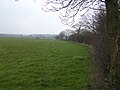
 A typical Cotswold field - geograph.org.uk - 385516.jpg 640 × 480; 102 KB
-
 Barnwood Park - geograph.org.uk - 358789.jpg 480 × 640; 202 KB
-

-
 St. Peter's and St. John's - geograph.org.uk - 483197.jpg 640 × 480; 107 KB
-
 Blockley - geograph.org.uk - 554071.jpg 640 × 480; 58 KB
-
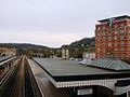
 Bourton-on-the-Water Station.jpg 640 × 480; 87 KB
-
 Brewery Hill - geograph.org.uk - 357023.jpg 640 × 480; 124 KB
-

-

-
 Chipping Sodbury Tunnel ventilation shaft 1.jpg 480 × 640; 127 KB
-
 Easter Compton PO.jpg 640 × 455; 52 KB
-
 Fordson tractor - geograph.org.uk - 371124.jpg 640 × 426; 139 KB
-
 Gloucester to Bristol train - geograph.org.uk - 367408.jpg 640 × 480; 88 KB
-
 Hetty Pegler's Tump - geograph.org.uk - 940263.jpg 640 × 480; 94 KB
-

-
-
 Nibley Mill before redevelopment - geograph.org.uk - 817074.jpg 640 × 426; 89 KB
-
 Old shed beside footpath to Ripple - geograph.org.uk - 373092.jpg 640 × 426; 136 KB
-
 Post office for the Witcombes - geograph.org.uk - 485592.jpg 640 × 480; 74 KB
-
 Post Office Stowage Van. - geograph.org.uk - 682297.jpg 640 × 482; 52 KB
-
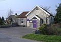
 Post Office, New Road, Olveston - geograph.org.uk - 381080.jpg 640 × 417; 64 KB
-
 South Wales express - geograph.org.uk - 380655.jpg 640 × 431; 65 KB
-
 Stone Stile - geograph.org.uk - 376798.jpg 480 × 640; 136 KB
-
 Stroud railway station in 2007.jpg 640 × 480; 63 KB
-
 Swans on the Lake March 2007 - geograph.org.uk - 392454.jpg 640 × 498; 98 KB
-
 The M5 motorway, looking north - geograph.org.uk - 381349.jpg 640 × 480; 49 KB
-
 The Vine, Awkley - geograph.org.uk - 381044.jpg 640 × 442; 69 KB
-

-
 View north near Angers Farm - geograph.org.uk - 489730.jpg 640 × 480; 88 KB
-

-
 Where Jumbos Go To Die - geograph.org.uk - 517834.jpg 640 × 456; 45 KB
-
 Which way^ - geograph.org.uk - 373214.jpg 640 × 477; 92 KB
-

-
 Ashfield Farm, Old Church Road - geograph.org.uk - 381352.jpg 640 × 472; 60 KB
-

-
 Derelict house at Manor Farm - geograph.org.uk - 489711.jpg 640 × 480; 85 KB
-
 Drive and footpath to Owlsnest Farm - geograph.org.uk - 489715.jpg 640 × 480; 107 KB
-
 Field and willows, Gaunt's Earthcott - geograph.org.uk - 489732.jpg 640 × 480; 62 KB
-
 Kyneton Park Lodge - geograph.org.uk - 381272.jpg 640 × 442; 65 KB
-
 M5 in the middle distance - geograph.org.uk - 489724.jpg 640 × 480; 53 KB
-
 Ploughed field, at Gate Farm - geograph.org.uk - 381286.jpg 640 × 455; 81 KB
-
 View south of Angers Farm - geograph.org.uk - 382423.jpg 640 × 480; 89 KB


.jpg)

.jpg)


