Category:March 2007 in the Metropolitan Borough of Calderdale
Media in category "March 2007 in the Metropolitan Borough of Calderdale"
The following 52 files are in this category, out of 52 total.
-
 Beaumont Clough Bridge - geograph.org.uk - 362610.jpg 640 × 453; 159 KB
-
 Black Hill, Booth Wood - geograph.org.uk - 373398.jpg 480 × 640; 129 KB
-
 Black Hill, Booth Wood - geograph.org.uk - 373680.jpg 640 × 480; 142 KB
-
 Blake Hill End, Shibden Dale - geograph.org.uk - 354295.jpg 640 × 480; 113 KB
-
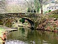 Burnt Acres Lane Bridge - geograph.org.uk - 364016.jpg 640 × 480; 158 KB
-
 Calderdale Line - geograph.org.uk - 366583.jpg 640 × 480; 127 KB
-
 Callis Wood - geograph.org.uk - 362624.jpg 640 × 448; 156 KB
-
 Callis Wood - geograph.org.uk - 362637.jpg 640 × 367; 141 KB
-
 Caty Well Bridge, Wainstalls - geograph.org.uk - 362762.jpg 640 × 480; 151 KB
-
 Caty Well Bridge, Wainstalls - geograph.org.uk - 362775.jpg 476 × 640; 151 KB
-
 Caty Well Brook, Wainstalls - geograph.org.uk - 362730.jpg 640 × 481; 152 KB
-
 Caty Well Brook, Wainstalls - geograph.org.uk - 362740.jpg 447 × 640; 163 KB
-
 Coley Beck Valley - geograph.org.uk - 379857.jpg 640 × 415; 74 KB
-
 Coley Beck Watermill - geograph.org.uk - 379852.jpg 480 × 640; 172 KB
-
 Dean House Farm, Luddenden Dean - geograph.org.uk - 363903.jpg 640 × 478; 102 KB
-
 Dean House Farm, Luddenden Dean - geograph.org.uk - 363908.jpg 640 × 463; 88 KB
-
 Doe Park Reservoir - geograph.org.uk - 358853.jpg 457 × 640; 164 KB
-
 Dunkirk, Shibden Dale - geograph.org.uk - 354283.jpg 473 × 640; 114 KB
-
 Field Head, Wainstalls - geograph.org.uk - 362832.jpg 640 × 456; 83 KB
-
 Field Head, Wainstalls - geograph.org.uk - 362838.jpg 640 × 480; 96 KB
-
 Great Rock, Upper Eastwood - geograph.org.uk - 381870.jpg 640 × 480; 95 KB
-
 Halifax Bus Station. - geograph.org.uk - 366762.jpg 640 × 480; 78 KB
-
 Hebden Bridge Station - geograph.org.uk - 353532.jpg 640 × 480; 146 KB
-
 Heeley Hill, Mankinholes - geograph.org.uk - 362521.jpg 640 × 480; 111 KB
-
 Hudson Mill - geograph.org.uk - 354267.jpg 640 × 480; 149 KB
-
 Ivy in Clifton Wood, Clifton - geograph.org.uk - 379560.jpg 640 × 480; 157 KB
-
 Jumble Hole Clough - geograph.org.uk - 381874.jpg 473 × 640; 151 KB
-
 Jumble Hole Clough - geograph.org.uk - 381875.jpg 480 × 640; 160 KB
-
 Jumble Hole Clough - geograph.org.uk - 381892.jpg 480 × 640; 144 KB
-
 Jumble Hole Road Bridge - geograph.org.uk - 381898.jpg 452 × 640; 129 KB
-
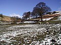
 Kershaw Farm, Erringden - geograph.org.uk - 362580.jpg 640 × 468; 107 KB
-
 Minor road at head of Widdop valley - geograph.org.uk - 1257208.jpg 640 × 480; 61 KB
-
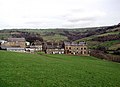
 New Manor House Farm - geograph.org.uk - 374279.jpg 640 × 473; 119 KB
-
 Oats Royd Mill, Luddenden Dean - geograph.org.uk - 363915.jpg 640 × 474; 96 KB
-
 Old Royd Lock, Todmorden - geograph.org.uk - 363985.jpg 640 × 480; 105 KB
-
 Old White Beare, Norwood Green - geograph.org.uk - 379839.jpg 640 × 480; 94 KB
-
 Over Whiskers, Shibden Dale - geograph.org.uk - 354304.jpg 457 × 640; 118 KB
-
 Paddock Road, Dunkirk - geograph.org.uk - 354289.jpg 468 × 640; 113 KB
-
 Quarry track - geograph.org.uk - 366541.jpg 640 × 480; 137 KB
-
 Raw Bank, Beestonley - geograph.org.uk - 375051.jpg 640 × 475; 100 KB
-
 Reservoir outlet - geograph.org.uk - 354290.jpg 640 × 480; 113 KB
-
 Ridings, Luddenden Dean - geograph.org.uk - 362859.jpg 640 × 480; 121 KB
-
 Rochdale Canal, Callis Wood - geograph.org.uk - 362646.jpg 467 × 640; 165 KB
-
 Rough Edge, Erringden Moor - geograph.org.uk - 362577.jpg 640 × 487; 99 KB
-
 Scarecrow near Egypt - geograph.org.uk - 354277 (cropped).jpg 205 × 365; 57 KB
-
 Scarecrow near Egypt - geograph.org.uk - 354277.jpg 640 × 367; 117 KB
-
 Shelf - Wade House Road - geograph.org.uk - 361643.jpg 622 × 416; 40 KB
-
 Wade Bridge, Luddenden Brook - geograph.org.uk - 362879.jpg 640 × 463; 157 KB
-
 Whiskers Lane - geograph.org.uk - 354369.jpg 453 × 640; 159 KB
-
 Whiteley Royd Farm - geograph.org.uk - 381873.jpg 458 × 640; 101 KB
-
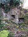
 Winch base - geograph.org.uk - 354286.jpg 640 × 480; 162 KB
-
 Woodland footpath above Hebden Water - geograph.org.uk - 615925.jpg 640 × 480; 141 KB


.jpg)


