Category:March 2009 in Scotland
Constituent countries of the United Kingdom: England · Northern Ireland · Scotland · Wales – British Crown dependencies: Jersey
Deutsch: Bilder, die im März 2009 in Scotland aufgenommen worden sind. Bitte beachten Sie, dass dies weder das Datum des Uploads noch das Datum des Scannens eines Fotos ist.
English: Images/pictures taken in Scotland during March 2009. Note this is not the date of the upload, nor the date a photo was scanned.
Español: Fotografías o imágenes tomadas en Scotland durante marzo 2009. No es la fecha de subida ni escaneo, sino la fecha en que las fotografías o imágenes se crearon.
Esperanto: Bildoj faritaj en Scotland en marto 2009. Tio ne estas la dato, kiam la bildoj estis alŝutitaj aŭ skanitaj.
Français : Photographies ou images prises en Scotland durant mars 2009. Ce n'est pas la date du téléchargement ou du scan.
Galego: Fotografías ou imaxes tomadas en Scotland durante marzo 2009. Non é a data de subida nin escaneamento, senón a data na que se crearon as fotografías ou imaxes.
Italiano: Fotografie o immagini scattate a Scotland nel marzo 2009. Nota bene: la data non si riferisce né a quella di upload né a quella in cui la foto è stata digitalizzata.
Norsk bokmål: Bilder tatt i Scotland i løpet av mars 2009. Merk at dette ikke er datoen for opplasting, eller når et bilde har blitt skannet.
Norsk nynorsk: Bilete teke i Scotland i løpet av mars 2009. Merk at dette ikkje er datoen for opplasting, eller når eit bilete har vorte skanna.
Русский: Изображения, сделанные в Scotland в течение март 2009 (не дата загрузки изображения).
Українська: Зображення, зроблені в Scotland протягом березень 2009. Зауважте, що це не дата завантаження чи дата сканування фотографії.
| March 2008 | ← | March 2009 | → | March 2010 | |||||||
| Jan | Feb | Mar | Apr | May | Jun | Jul | Aug | Sep | Oct | Nov | Dec |
| 23 | 27 | 44 | 21 | 41 | 28 | 48 | 36 | 19 | 17 | 27 | 16 |
|---|---|---|---|---|---|---|---|---|---|---|---|
Subcategories
This category has the following 3 subcategories, out of 3 total.
Media in category "March 2009 in Scotland"
The following 41 files are in this category, out of 41 total.
-
 "End of footpath" - geograph.org.uk - 1222248.jpg 640 × 417; 105 KB
-
 "Man proposes, God disposes" - geograph.org.uk - 1226020.jpg 640 × 427; 62 KB
-
 'Dufftown in Bloom' - geograph.org.uk - 1200393.jpg 640 × 480; 125 KB
-
 A Charlestown scene - geograph.org.uk - 1184479.jpg 640 × 480; 79 KB
-

-
 A most disturbing view - geograph.org.uk - 1236071.jpg 640 × 480; 88 KB
-
 A pair of white houses near Moffat - geograph.org.uk - 1209394.jpg 640 × 480; 69 KB
-
 A rainbow over Addinston farmland - geograph.org.uk - 1188386.jpg 427 × 640; 197 KB
-
 A rough grazing field at Abbey Knowe - geograph.org.uk - 1229432.jpg 640 × 430; 139 KB
-
 A row of cottages in Airdrie - geograph.org.uk - 1214343.jpg 640 × 480; 65 KB
-
 A sign for Minsca Wind Farm - geograph.org.uk - 1227994.jpg 427 × 640; 119 KB
-
 A view of Dunfermline (2) - geograph.org.uk - 1218367.jpg 640 × 426; 90 KB
-
 Airdrie Academy - geograph.org.uk - 1227116.jpg 640 × 480; 71 KB
-
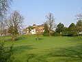
 Baldernock Church from the road.jpg 1,586 × 1,189; 857 KB
-
 Bell Street - geograph.org.uk - 1218292.jpg 640 × 480; 74 KB
-
 Blantyre Leisure Centre - geograph.org.uk - 1218345.jpg 640 × 481; 136 KB
-
 BP station, Milngavie Road - geograph.org.uk - 1220473.jpg 640 × 480; 133 KB
-
 Bridge over the Eddleston Water - geograph.org.uk - 1185503.jpg 640 × 480; 119 KB
-
 Cirrus focused on the May - geograph.org.uk - 1198796.jpg 640 × 288; 14 KB
-

-
 Entrance to Singer Station - geograph.org.uk - 1222685.jpg 640 × 480; 130 KB
-
 Farmland near Addinston - geograph.org.uk - 1188367.jpg 640 × 427; 143 KB
-
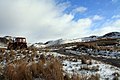
 Glasgow to Dumbarton railway - geograph.org.uk - 1471257.jpg 640 × 480; 127 KB
-
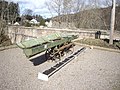
 Hunterston Big Cranes (3390349378).jpg 1,600 × 1,062; 243 KB
-
 Lauder Road, Kirkcaldy.jpg 3,264 × 2,448; 2.87 MB
-
 Looking down the Eddleston Water - geograph.org.uk - 1185507.jpg 640 × 480; 117 KB
-
 Manor Water and the Tweed - geograph.org.uk - 1217357.jpg 640 × 424; 112 KB
-
 Manor Water bridge, Kirkton - geograph.org.uk - 1197956.jpg 640 × 424; 128 KB
-
 Orkney v Shetland netball 2009.jpg 3,153 × 2,102; 1.12 MB
-

-
 Shawhill House, Crookedholm.JPG 2,288 × 1,712; 1.34 MB
-
 Sheepfold at Blynlee Quarry - geograph.org.uk - 1194521.jpg 640 × 480; 87 KB
-
 Sheepfold at spot height, 301m - geograph.org.uk - 1192958.jpg 640 × 480; 126 KB
-
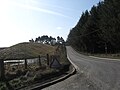 The A6094 heading towards Howgate - geograph.org.uk - 1210814.jpg 640 × 480; 62 KB
-
 The Burn At The Deil's Elbow - geograph.org.uk - 1191855.jpg 399 × 600; 71 KB
-
 The Esk Valley footpath - geograph.org.uk - 1210710.jpg 640 × 480; 117 KB
-
 The Former Free Church In Ayr - geograph.org.uk - 1194789.jpg 379 × 600; 60 KB
-
 The village of Howgate - geograph.org.uk - 1210880.jpg 570 × 640; 68 KB
-
 Towards Ailsa Craig - geograph.org.uk - 1199426.jpg 640 × 408; 75 KB
-
 Tractor and Track - geograph.org.uk - 1196660.jpg 640 × 427; 70 KB
-


_-_geograph.org.uk_-_1218367.jpg)


.jpg)


