Category:March 2011 in the East Riding of Yorkshire
Ceremonial counties of England: Bedfordshire · Berkshire · Buckinghamshire · Cambridgeshire · Cheshire · Cornwall · Cumbria · Derbyshire · Devon · Dorset · Durham · East Riding of Yorkshire · East Sussex · Essex · Gloucestershire · Greater London · Greater Manchester · Hampshire · Herefordshire · Hertfordshire · Isle of Wight · Kent · Lancashire · Leicestershire · Lincolnshire · Merseyside · Norfolk · North Yorkshire · Northamptonshire · Northumberland · Nottinghamshire · Oxfordshire · Shropshire · Somerset · South Yorkshire · Staffordshire · Suffolk · Surrey · Tyne and Wear · Warwickshire · West Midlands · West Sussex · West Yorkshire · Wiltshire · Worcestershire
City-counties: Bristol ·
Former historic counties:
Other former counties:
City-counties: Bristol ·
Former historic counties:
Other former counties:
Ok
Deutsch: Bilder, die im März 2011 in the East Riding of Yorkshire aufgenommen worden sind. Bitte beachten Sie, dass dies weder das Datum des Uploads noch das Datum des Scannens eines Fotos ist.
English: Images/pictures taken in the East Riding of Yorkshire during March 2011. Note this is not the date of the upload, nor the date a photo was scanned.
Español: Fotografías o imágenes tomadas en the East Riding of Yorkshire durante marzo 2011. No es la fecha de subida ni escaneo, sino la fecha en que las fotografías o imágenes se crearon.
Esperanto: Bildoj faritaj en the East Riding of Yorkshire en marto 2011. Tio ne estas la dato, kiam la bildoj estis alŝutitaj aŭ skanitaj.
Français : Photographies ou images prises en the East Riding of Yorkshire durant mars 2011. Ce n'est pas la date du téléchargement ou du scan.
Galego: Fotografías ou imaxes tomadas en the East Riding of Yorkshire durante marzo 2011. Non é a data de subida nin escaneamento, senón a data na que se crearon as fotografías ou imaxes.
Italiano: Fotografie o immagini scattate a the East Riding of Yorkshire nel marzo 2011. Nota bene: la data non si riferisce né a quella di upload né a quella in cui la foto è stata digitalizzata.
Norsk bokmål: Bilder tatt i the East Riding of Yorkshire i løpet av mars 2011. Merk at dette ikke er datoen for opplasting, eller når et bilde har blitt skannet.
Norsk nynorsk: Bilete teke i the East Riding of Yorkshire i løpet av mars 2011. Merk at dette ikkje er datoen for opplasting, eller når eit bilete har vorte skanna.
Русский: Изображения, сделанные в the East Riding of Yorkshire в течение март 2011 (не дата загрузки изображения).
Українська: Зображення, зроблені в the East Riding of Yorkshire протягом березень 2011. Зауважте, що це не дата завантаження чи дата сканування фотографії.
| March 2010 | ← | March 2011 | → | March 2012 | |||||||
| Jan | Feb | Mar | Apr | May | Jun | Jul | Aug | Sep | Oct | Nov | Dec |
| 16 | 35 | 82 | 46 | 84 | 30 | 58 | 28 | 28 | 52 | 50 | 43 |
|---|---|---|---|---|---|---|---|---|---|---|---|
Subcategories
This category has only the following subcategory.
Media in category "March 2011 in the East Riding of Yorkshire"
The following 81 files are in this category, out of 81 total.
-
 A minor road towards Foggathorpe (geograph 2289945).jpg 800 × 600; 245 KB
-
 A63 towards Hull (geograph 2324927).jpg 1,600 × 1,200; 456 KB
-
 A63 towards Hull (geograph 2324932).jpg 1,600 × 1,200; 582 KB
-
 Barmby Marsh water treatment works (geograph 2324590).jpg 1,600 × 1,200; 306 KB
-
 Beacon Road, north towards Great Givendale (geograph 2325613).jpg 800 × 600; 168 KB
-
 Beverley Rail Station - panoramio.jpg 1,100 × 660; 830 KB
-
 Beverley Station footbridge - panoramio.jpg 1,100 × 733; 418 KB
-
 Bishop Burton - panoramio.jpg 2,000 × 603; 601 KB
-
 Black Mill Beverley.jpg 2,592 × 3,888; 1.26 MB
-
 Black Swan Inn, Asselby (geograph 2324508).jpg 1,600 × 1,200; 240 KB
-
 Bridge over the River Derwent (geograph 2324597).jpg 1,600 × 1,200; 369 KB
-
 Bridleway towards Spaldington Common (geograph 2324971).jpg 1,600 × 1,200; 607 KB
-
 Brind Lane (geograph 2324955).jpg 1,600 × 1,200; 590 KB
-
 Brind Lane towards Brind (geograph 2289992).jpg 800 × 600; 259 KB
-
 Brind Lane, Brind (geograph 2324962).jpg 1,600 × 1,200; 282 KB
-
 Brind Lane, Brind (geograph 2324965).jpg 1,600 × 1,200; 497 KB
-
 Brindleys Lane to Brind Leys Farm (geograph 2289986).jpg 800 × 600; 328 KB
-
 Cottingham Park, Cottingham, East Yorkshire - panoramio.jpg 666 × 1,000; 235 KB
-
 Coyote Tactical Support Vehicle (TSV) MOD 45152541.jpg 3,000 × 2,000; 980 KB
-
 Coyote Tactical Support Vehicle (TSV) MOD 45152542.jpg 3,000 × 2,000; 1.16 MB
-
 Coyote Tactical Support Vehicle (TSV) MOD 45152543.jpg 3,000 × 2,000; 743 KB
-
 Coyote Tactical Support Vehicle (TSV) MOD 45152544.jpg 3,000 × 2,000; 1.04 MB
-
 Coyote Tactical Support Vehicle (TSV) MOD 45152545.jpg 3,000 × 2,000; 778 KB
-
 Coyote Tactical Support Vehicle (TSV) MOD 45152546.jpg 3,000 × 2,000; 795 KB
-
 Dene Wood, Cottingham, Yorkshire, autumn, IMG 2775 - panoramio.jpg 666 × 1,000; 229 KB
-
 Downhill into Fordon, East Yorkshire (geograph 2317866).jpg 800 × 600; 285 KB
-
 Drainage ditch near Brind Leys Farm (geograph 2324945).jpg 1,600 × 1,200; 646 KB
-
 Drewtonairshaft2.jpg 650 × 480; 198 KB
-
 Drewtonairshaft2a.jpg 650 × 443; 171 KB
-
 East End Farm, Asselby (geograph 2324494).jpg 1,600 × 1,200; 398 KB
-
 Entering Wetwang, East Yorkshire - geograph.org.uk - 2300062.jpg 800 × 600; 274 KB
-
 Farm buildings off North Cotes Road (geograph 2319189).jpg 800 × 600; 204 KB
-
 Farmland looking towards Brindleys Plantation (geograph 2324963).jpg 1,600 × 1,200; 389 KB
-
 Farmland near Brind Leys Farm (geograph 2324946).jpg 1,600 × 1,200; 506 KB
-
 Farmland near Knedlington (geograph 2324437).jpg 1,600 × 1,200; 265 KB
-
 Farmland south of Wressle (geograph 2324924).jpg 1,600 × 1,200; 478 KB
-
 Field entrance, Brind (geograph 2324960).jpg 1,600 × 1,200; 437 KB
-
 Grazing land, Newsholme (geograph 2324930).jpg 1,600 × 1,200; 756 KB
-
 Grimthorpe Hill towards Great Givendale (geograph 2325601).jpg 800 × 600; 297 KB
-
 Hedgerow beside Brind Lane (geograph 2324956).jpg 1,600 × 1,200; 760 KB
-
 Hedon Police Station, Hedon near Hull - geograph.org.uk - 2293311.jpg 800 × 600; 177 KB
-
 Hotham Street building,Drypool and Marfleet Steam Tramways Company.JPG 1,024 × 768; 437 KB
-
 Intake Plantation (geograph 2324941).jpg 1,600 × 1,200; 428 KB
-
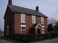
 Knedlington Old Hall (geograph 2324430).jpg 640 × 480; 92 KB
-
 Loglands Nature Reserve, Kingston upon Hull (geograph 5594160).jpg 2,816 × 2,112; 1.45 MB
-
 Loglands Nature Reserve, Kingston upon Hull (geograph 5594477).jpg 2,816 × 2,112; 1.51 MB
-
 Loglands Nature Reserve, Kingston upon Hull (geograph 5596449).jpg 2,112 × 2,816; 1.45 MB
-
 Looking west along North Cotes Road (geograph 2321027).jpg 800 × 600; 196 KB
-
 Main Street, Asselby (geograph 2324503).jpg 1,600 × 1,200; 474 KB
-
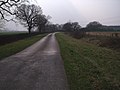
 Minor road towards Asselby (geograph 2324441).jpg 1,600 × 1,200; 293 KB
-
 Minor road towards the A63 (geograph 2324943).jpg 1,600 × 1,200; 380 KB
-
 Minor road towards Wressle (geograph 2324923).jpg 1,600 × 1,200; 458 KB
-
 North Promenade (geograph 2295498).jpg 640 × 427; 75 KB
-
 Power lines near Newsholme (geograph 2324926).jpg 1,600 × 1,200; 186 KB
-

-
 Road junction Brind Lane with the B1228 (geograph 2324969).jpg 1,600 × 1,200; 422 KB
-
 Rowland Hall (geograph 2324938).jpg 1,600 × 1,200; 466 KB
-
 Rowland Hall Plantation (geograph 2324935).jpg 1,600 × 1,200; 808 KB
-
 Snuff Mill Lane road.JPG 1,024 × 768; 443 KB
-
 St James Church, Fordon (geograph 2318006).jpg 800 × 600; 327 KB
-
 St James Church, Fordon (geograph 2318018).jpg 800 × 600; 313 KB
-
 St James Church, Fordon (geograph 2335951).jpg 800 × 600; 357 KB
-
 Substation, Dundee Street, Hull.jpg 1,024 × 668; 318 KB
-
 Substation, Saner Street, Hull 2.jpg 1,024 × 768; 405 KB
-
 Substation, Saner Street, Hull 3.jpg 1,024 × 768; 372 KB
-
 Substation, Saner Street, Hull.jpg 1,024 × 768; 385 KB
-
 The B1228 at Newsholme Farm (geograph 2289955).jpg 800 × 600; 224 KB
-
 The Police Station, on Station Road, Withernsea (geograph 2297814).jpg 800 × 600; 234 KB
-
 The River Derwent (geograph 2324601).jpg 1,600 × 1,200; 306 KB
-
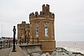
 The Sandcastle (geograph 2295477).jpg 640 × 427; 80 KB
-
 The Sandcastle (geograph 2295486).jpg 640 × 427; 68 KB
-
 The Sandcastle (geograph 2295487).jpg 640 × 427; 56 KB
-
 The way to Danebury Manor near Fordon (geograph 2317863).jpg 800 × 600; 204 KB
-
 The way to Glebe Farm at York Lane - geograph.org.uk - 2299912.jpg 800 × 600; 235 KB
-
 Track to Wood Farm (geograph 2324951).jpg 1,600 × 1,200; 354 KB
-
 Trig point No.S6335 to the south of Fordon (geograph 2318031).jpg 800 × 600; 220 KB
-
 Upside down Union Flags No10 (geograph 2297983).jpg 800 × 600; 159 KB
-
 Withernsea Lighthouse (geograph 2295509).jpg 427 × 640; 37 KB
-
 Wold Newton Gas Installation, North Cotes Road (geograph 2319193).jpg 800 × 600; 301 KB
-
 Woodland near Wood Farm (geograph 2324952).jpg 1,600 × 1,200; 460 KB
-
 York Road, Little Driffield - geograph.org.uk - 2305753.jpg 800 × 600; 257 KB
.jpg)
.jpg)
.jpg)
.jpg)


.jpg)
.jpg)
.jpg)
.jpg)
.jpg)
.jpg)
.jpg)
.jpg)

_MOD_45152541.jpg)
_MOD_45152542.jpg)
_MOD_45152543.jpg)
_MOD_45152544.jpg)
_MOD_45152545.jpg)
_MOD_45152546.jpg)

.jpg)
.jpg)


.jpg)

.jpg)
.jpg)
.jpg)
.jpg)
.jpg)
.jpg)
.jpg)
.jpg)
.jpg)


.jpg)
.jpg)
.jpg)
.jpg)
.jpg)
.jpg)
.jpg)
.jpg)
.jpg)
.jpg)
.jpg)
.jpg)
.jpg)
.jpg)
.jpg)
.jpg)

.jpg)
.jpg)
.jpg)


.jpg)
.jpg)
.jpg)
.jpg)
.jpg)
.jpg)
.jpg)

.jpg)
.jpg)
.jpg)
.jpg)
.jpg)
.jpg)

.jpg)