Category:Mariä Himmelfahrt (Pulst)
| Object location | | View all coordinates using: OpenStreetMap |
|---|
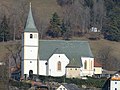
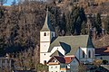
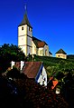
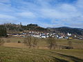
church building in Liebenfels, Austria  | |||||
| Upload media | |||||
| Instance of | |||||
|---|---|---|---|---|---|
| Named after | |||||
| Location | Liebenfels, Sankt Veit an der Glan District, Carinthia, Austria | ||||
| Street address |
| ||||
| Heritage designation | |||||
 | |||||
| This category shows the protected monument with the number 26882 in Austria. (Commons, de, Wikidata) |
Subcategories
This category has only the following subcategory.
M
Media in category "Mariä Himmelfahrt (Pulst)"
The following 21 files are in this category, out of 21 total.
-
 Kirche u Karner Pulst.JPG 4,000 × 3,000; 4.59 MB
-
 Liebenfels Pulst 19042007 03.jpg 2,464 × 1,632; 705 KB
-
 Liebenfels Pulst Kirchplatz 5 Pfarrkirche Mariä Himmelfahrt SO-Ansicht 12022022 9092.jpg 4,928 × 3,280; 11.12 MB
-
 Liebenfels Pulst Kirchplatz 5 Pfarrkirche Mariä Himmelfahrt SO-Ansicht 12022022 9097.jpg 4,928 × 3,280; 11.46 MB
-
 Liebenfels Pulst Kirchplatz 5 Pfarrkirche Mariä Himmelfahrt und Karner 21082017 0506.jpg 5,849 × 4,431; 15.48 MB
-

-

-
 Liebenfels Pulst SO-Ansicht 12022022 2164.jpg 7,360 × 4,912; 22.36 MB
-
 Liebenfels Pulst SO-Ansicht 27042020 7441.jpg 4,928 × 3,280; 9.25 MB
-
 Liebenfels Pulst SO-Ansicht 27042020 7442.jpg 4,928 × 3,280; 10.42 MB
-
 Liebenfels Pulst Pfarrkirche Mariae Himmelfahrt 27072007 01.jpg 2,592 × 3,872; 1.38 MB
-
 Liebenfels Pulst Pfarrkirche Mariae Himmelfahrt 30082009 66.jpg 2,160 × 3,144; 3.24 MB
-
 Maria Pulst Nordportal.jpg 3,815 × 3,390; 2.77 MB
-
 Pulst Chorgestühl.jpg 3,000 × 4,000; 3.89 MB
-
 Pulst Covnerta.jpg 4,000 × 3,000; 4.55 MB
-
 Pulst Grabinschrift C Cantonius Ucco.jpg 4,000 × 3,000; 4.76 MB
-
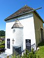 Pulst Karner.jpg 3,000 × 4,000; 4.35 MB
-
 Pulst Kirchturm 1534.jpg 3,000 × 4,000; 4.22 MB
-
 Pulst Relief Dienerin.jpg 3,000 × 4,000; 4.27 MB
-
 Pulst Sakristei.jpg 4,000 × 3,000; 4.54 MB
-
 Pulst.JPG 4,000 × 3,000; 4.61 MB


