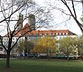
Category:Marienhof (München)
| Object location | | View all coordinates using: OpenStreetMap |
|---|
public square in Altstadt-Lehel, Germany | |||||
| Upload media | |||||
| Instance of |
| ||||
|---|---|---|---|---|---|
| Named after | |||||
| Location | Altstadt (Munich), Munich, Upper Bavaria, Bavaria, Germany | ||||
| Inception |
| ||||
| Significant event |
| ||||
| Area |
| ||||
 | |||||
Subcategories
This category has only the following subcategory.
Media in category "Marienhof (München)"
The following 41 files are in this category, out of 41 total.
-
140929Hofbräuhaus am Platzl, Munich, Germany4.jpg 5,472 × 3,648; 8.52 MB
-
140929Hofbräuhaus am Platzl, Munich, Germany5.jpg 3,648 × 5,472; 8.03 MB
-
140929Hofbräuhaus am Platzl, Munich, Germany6.jpg 5,472 × 3,648; 8.32 MB
-
15.06.2013. München - Viktualienmarkt - panoramio.jpg 2,592 × 1,944; 451 KB
-
20220829 Museumsdepot der Landeshauptstadt München 03.jpg 6,016 × 4,016; 10.24 MB
-
Baumtransport 1.jpg 3,648 × 2,736; 3.04 MB
-
Baumtransport 2.jpg 3,648 × 2,736; 2.91 MB
-
Baumtransport 3.jpg 2,736 × 3,648; 3.49 MB
-
Baumtransport 4.jpg 3,648 × 2,736; 2.94 MB
-
DEU Zeitungsautomaten Muenchen 3712 MSZ100320.jpg 2,000 × 1,514; 2.98 MB
-
Doppelstockfahrradparker Marienplatz.jpg 945 × 585; 885 KB
-
Drachenzählerlied IV-1 A.JPG 4,209 × 2,822; 3.09 MB
-
Drachenzählerlied IV-1 B.JPG 2,860 × 4,297; 4.94 MB
-
Hyon Soo Kim Weißer Lotus (München, Marienhof).jpg 5,312 × 2,988; 4.36 MB
-
Marienhof - panoramio (2).jpg 2,046 × 2,048; 528 KB
-
Marienhof - panoramio.jpg 1,595 × 1,107; 776 KB
-
Marienhof 2017-12.jpg 5,379 × 3,587; 3.31 MB
-
Marienhof Juni 2013 Muenchen-1.jpg 2,559 × 1,902; 1.22 MB
-
Marienhof Juni 2013 Muenchen-2.jpg 2,454 × 1,716; 1.09 MB
-
Marienhof Juni 2013 Muenchen-3.jpg 2,592 × 1,773; 999 KB
-
Marienhof Muenchen.jpg 5,312 × 2,988; 4.8 MB
-
Marienhof München Juni 2021.jpg 4,458 × 2,507; 5.9 MB
-
Marienhof München.jpg 4,000 × 3,000; 17.21 MB
-
Marienhof Neues Rathaus München Rückseite.jpg 3,000 × 4,000; 13.68 MB
-
MUC Dallmayr Fassade Abends 2013-08.jpg 1,523 × 1,142; 671 KB
-
Muenchen Marienhof-1.jpg 2,550 × 1,900; 1.31 MB
-
Muenchen Marienhof-2.jpg 2,300 × 1,900; 1.29 MB
-
Muenchen Marienhof-3.jpg 2,200 × 1,900; 1.19 MB
-
Munich - Marienhof 2.jpg 3,000 × 1,976; 928 KB
-
Munich - Marienhof 3.jpg 6,410 × 2,653; 2.27 MB
-
Munich - Marienhof.jpg 7,638 × 2,575; 2.89 MB
-
Munich Oct 2020 12 04 45 502000.jpeg 4,032 × 3,024; 4.69 MB
-
Munich WM fever (142872932).jpg 2,592 × 1,944; 2.16 MB
-
Munich, 2013 (10381192543).jpg 2,736 × 2,736; 697 KB
-
Munich, Marienhof.jpg 4,288 × 2,848; 8.67 MB
-
München (10410480535).jpg 4,320 × 3,240; 4.38 MB
-
München (9487897217).jpg 5,184 × 3,456; 4.27 MB
-
München Blick vom Neuen Rathaus nach Norden September 2017.jpg 4,000 × 2,666; 4.86 MB
-
München, der Frauenkirche.JPG 4,912 × 3,264; 6.09 MB
-
Schrammerstraße.png 3,642 × 1,943; 9.9 MB
-
The Center Of Munich (214641075).jpeg 2,048 × 1,527; 681 KB


