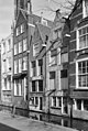
Category:Markt 34, Delft
| Object location | | View all coordinates using: OpenStreetMap |
|---|
 | |||||
| Upload media | |||||
| Instance of |
| ||||
|---|---|---|---|---|---|
| Location | Delft, South Holland, Netherlands | ||||
| Street address |
| ||||
| Heritage designation |
| ||||
 | |||||
|
This is a category about rijksmonument number 11914
|
| Address |
|
Media in category "Markt 34, Delft"
The following 4 files are in this category, out of 4 total.
-
 Achtergevels - Delft - 20051172 - RCE.jpg 806 × 1,200; 241 KB
-
 Delft - Markt 34.jpg 1,944 × 2,592; 1.25 MB
-
 Overzicht van de gevelwanden aan de Markt - Delft - 20386381 - RCE.jpg 1,200 × 960; 366 KB
-
 Overzicht van de gevelwanden aan de Markt - Delft - 20386416 - RCE.jpg 1,200 × 960; 358 KB


