Category:Marquette County, Michigan
Counties of Michigan: Alcona · Alger · Allegan · Alpena · Antrim · Arenac · Baraga · Barry · Bay · Benzie · Berrien · Branch · Calhoun · Cass · Charlevoix · Cheboygan · Chippewa · Clare · Clinton · Crawford · Delta · Dickinson · Eaton · Emmet · Genesee · Gladwin · Gogebic · Grand Traverse · Gratiot · Hillsdale · Houghton · Huron · Ingham · Ionia · Iosco · Iron · Isabella · Jackson · Kalamazoo · Kalkaska · Kent · Keweenaw · Lake · Lapeer · Leelanau · Lenawee · Livingston · Luce · Mackinac · Macomb · Manistee · Marquette · Mason · Mecosta · Menominee · Midland · Missaukee · Monroe · Montcalm · Montmorency · Muskegon · Newaygo · Oakland · Oceana · Ogemaw · Ontonagon · Osceola · Oscoda · Otsego · Ottawa · Presque Isle · Roscommon · Saginaw · Sanilac · Schoolcraft · Shiawassee · St. Clair · St. Joseph · Tuscola · Van Buren · Washtenaw · Wayne · Wexford
county in the Upper Peninsula of Michigan, United States   | |||||
| Upload media | |||||
| Instance of |
| ||||
|---|---|---|---|---|---|
| Named after | |||||
| Location | Michigan | ||||
| Located in or next to body of water | |||||
| Capital | |||||
| Item operated |
| ||||
| Inception |
| ||||
| Population |
| ||||
| Area |
| ||||
| Different from | |||||
| official website | |||||
 | |||||
Subcategories
This category has the following 7 subcategories, out of 7 total.
B
G
M
Media in category "Marquette County, Michigan"
The following 31 files are in this category, out of 31 total.
-
 05 Summer trip 04 Da Yoopers Tourist Trap Cropped.JPG 1,078 × 361; 83 KB
-
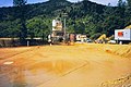 Acid Mine Drainage.jpg 600 × 398; 46 KB
-
 Bikers on a Former Landfill.jpg 3,840 × 2,160; 3.9 MB
-
 Empire & Tilden Iron Mines, MI.jpg 720 × 480; 228 KB
-
 Grypania spiralis, Empire Mine near Ishpeming MI.jpg 2,882 × 1,295; 3.2 MB
-

-
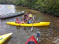 Kayak in Marquette.jpg 960 × 720; 83 KB
-
 M-15 centerline 1917 edit.png 795 × 465; 309 KB
-
 M-15 centerline 1917 printed cleaned 2.jpg 3,294 × 1,916; 2.73 MB
-
 M-15 centerline 1917 printed cleaned combined.jpg 3,289 × 1,903; 3 MB
-
 M-15 centerline 1917 printed cleaned.jpg 3,294 × 1,916; 2.32 MB
-
 M-15 centerline 1917 printed edit.jpg 3,294 × 1,916; 7.48 MB
-
 M-15 centerline 1917 printed.jpg 3,294 × 1,916; 16.1 MB
-
 M-15 centerline 1917.jpg 4,200 × 2,400; 1.33 MB
-
 M-15 centerline 1917.png 795 × 465; 239 KB
-
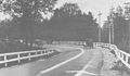
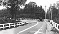
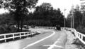
 M-94 bridge over East Branch Chocolay River.jpg 4,032 × 3,024; 2.79 MB
-
 Marqtran bus in Negaunee.jpg 4,496 × 3,000; 3.3 MB
-
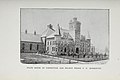 Michigan official directory and legislative manual for the years (1905) (14783981873).jpg 3,536 × 2,372; 1.54 MB
-
 Mormorsgruvanemigrationplaquette06170019.jpg 1,600 × 1,200; 363 KB
-
 New Friends (Unsplash).jpg 6,016 × 4,000; 7.06 MB
-
 Palmer rock piles.JPG 3,008 × 2,000; 1.53 MB
-
 Sawyer AFB - MI - 28 Apr 1998.jpg 526 × 702; 122 KB
-
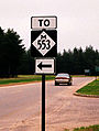 Small m-553.jpg 160 × 212; 39 KB
-
-
 Thefirstruralhighwaycenterline.png 796 × 784; 348 KB
-
 USA Marquette County, Michigan age pyramid.svg 520 × 600; 9 KB
-
 Witness Post - Survey Marker (32423696314).jpg 5,760 × 3,840; 9.94 MB
-
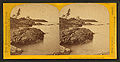
 Fish cave, Marquette, from Robert N. Dennis collection of stereoscopic views.jpg 2,737 × 1,374; 1.68 MB
-
 Light House Point, Bay of Marquette, by Carbutt, John, 1832-1905.jpg 2,737 × 1,407; 1.51 MB
-
 Pic Nic Rocks, Bay of Marquette, by Carbutt, John, 1832-1905.jpg 2,737 × 1,382; 1.51 MB
-
 View on the shore, Bay of Marquette, by Carbutt, John, 1832-1905.jpg 2,737 × 1,358; 1.64 MB


_(14783981873).jpg)

.jpg)


.jpg)


