Category:Marsden, Tyne and Wear
village in South Tyneside, UK  | |||||
| Upload media | |||||
| Instance of | |||||
|---|---|---|---|---|---|
| Location | South Tyneside, Tyne and Wear, North East England, England | ||||
 | |||||
Subcategories
This category has the following 2 subcategories, out of 2 total.
M
Media in category "Marsden, Tyne and Wear"
The following 22 files are in this category, out of 22 total.
-
 Camel's Island, Marsden Bay - geograph.org.uk - 3756719.jpg 1,066 × 800; 152 KB
-

-
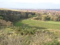 Disused quarry Marsden - geograph.org.uk - 1585605.jpg 640 × 480; 97 KB
-
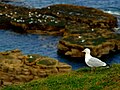 Gull resting on the cliffs between Whitburn and Marsden.jpg 2,439 × 1,839; 456 KB
-
 Limekilns, Marsden - geograph.org.uk - 162199.jpg 640 × 482; 95 KB
-
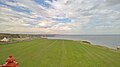 Looking north from Souter Lighthouse - geograph.org.uk - 5123108.jpg 5,376 × 3,024; 1.68 MB
-

-
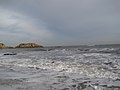
 Marsden Bay (2) - geograph.org.uk - 4619118.jpg 640 × 480; 59 KB
-
 Marsden Bay (3) - geograph.org.uk - 4619121.jpg 640 × 480; 53 KB
-
 Marsden Bay - geograph.org.uk - 4619116.jpg 640 × 480; 56 KB
-
 Marsden Bay and Camel's Island - geograph.org.uk - 3756712.jpg 1,066 × 800; 127 KB
-
 Marsden Bay at South Shields - geograph.org.uk - 5676004.jpg 800 × 600; 140 KB
-
 Marsden Bay from the South - geograph.org.uk - 2931248.jpg 2,889 × 2,167; 1.37 MB
-
 Marsden Rock by John Jackson.png 886 × 605; 759 KB
-
 Marsden station geograph-3783569-by-Ben-Brooksbank.jpg 2,318 × 1,466; 2.06 MB
-
 Marsdenkilns.jpg 3,248 × 2,160; 2.45 MB
-
 Quarry plant - geograph.org.uk - 506667.jpg 640 × 480; 119 KB
-
 Redwell Lane, Marsden - geograph.org.uk - 4157045.jpg 2,617 × 1,375; 2.13 MB
-
 Souter Lighthouse, a National Trust property - geograph.org.uk - 5114989.jpg 3,072 × 1,728; 1.29 MB
-
 Souter Lighthouse, Marsden, Tyne and Wear.jpeg 1,056 × 1,408; 115 KB
-
 The Marsden Coast - geograph.org.uk - 2473221.jpg 1,024 × 651; 81 KB
-
 View across Marsden Bay - geograph.org.uk - 3164533.jpg 4,608 × 3,456; 4.41 MB


_-_geograph.org.uk_-_4619118.jpg)
_-_geograph.org.uk_-_4619121.jpg)


