Category:Marston, Cheshire
English: Marston is a village in the the unitary authority of Cheshire West and Chester and the ceremonial county of Cheshire in the north west of England, on the River Weaver, close to Anderton and the Anderton Boat Lift; it lies south of Great Budworth and north of Northwich.
village and civil parish in Cheshire West and Chester, Cheshire, England   | |||||
| Upload media | |||||
| Instance of | |||||
|---|---|---|---|---|---|
| Location | Cheshire West and Chester, Cheshire, North West England, England | ||||
| Area |
| ||||
| Different from | |||||
 | |||||
Subcategories
This category has the following 4 subcategories, out of 4 total.
Media in category "Marston, Cheshire"
The following 86 files are in this category, out of 86 total.
-
 A corner full of maize, south of Marston Hall - geograph.org.uk - 5184831.jpg 1,024 × 768; 108 KB
-
 A Wide Pool on Forge Brook - geograph.org.uk - 2263634.jpg 1,200 × 804; 338 KB
-
 A559 at Higher Marston - geograph.org.uk - 3170117.jpg 640 × 480; 50 KB
-
 A559 near Higher Marston - geograph.org.uk - 3170100.jpg 640 × 480; 51 KB
-
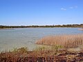
 Adelaide Flash (east) - geograph.org.uk - 5605676.jpg 640 × 481; 323 KB
-
 Adelaide Flash (west) - geograph.org.uk - 5605682.jpg 640 × 481; 354 KB
-

-
 Adelaide Flash, Marston - geograph.org.uk - 5184708.jpg 1,024 × 768; 184 KB
-
 Adelaide salt works - geograph.org.uk - 4728608.jpg 640 × 480; 42 KB
-
 Animal feed factory, Wincham - geograph.org.uk - 5185760.jpg 1,024 × 768; 135 KB
-
 Bird Hide, Neumann's Flashes - geograph.org.uk - 5605734.jpg 640 × 480; 618 KB
-
 Budworth Mere - geograph.org.uk - 3119150.jpg 640 × 481; 605 KB
-
 Budworth Mere Sailing Club - geograph.org.uk - 4903185.jpg 1,024 × 768; 149 KB
-
 Canal and farmland near Higher Marston, Cheshire - geograph.org.uk - 2723323.jpg 1,024 × 550; 422 KB
-
 Canal tow-path in August 2005 - geograph.org.uk - 3021794.jpg 1,024 × 769; 228 KB
-
 Cheshire farm land near Higher Marston - geograph.org.uk - 2723339.jpg 1,024 × 525; 355 KB
-
 Countryside North of Northwich - geograph.org.uk - 5242125.jpg 2,784 × 1,568; 2.19 MB
-

-
 Farmland by Marston Hall, Cheshire - geograph.org.uk - 2723246.jpg 1,024 × 605; 353 KB
-
 Field, Lane Ends - geograph.org.uk - 5824216.jpg 1,024 × 683; 236 KB
-
 Fields at Higher Marston - geograph.org.uk - 4904100.jpg 1,024 × 768; 165 KB
-
 Fingerpost at Lane Ends, Higher Marston - geograph.org.uk - 5531104.jpg 768 × 1,024; 250 KB
-
 Footpath at Higher Marston - geograph.org.uk - 4904107.jpg 1,024 × 768; 123 KB
-
 Footpath at Higher Marston - geograph.org.uk - 4904110.jpg 1,024 × 768; 173 KB
-
 Footpath between Marston Hall and Ollershaw Lane - geograph.org.uk - 4904115.jpg 1,024 × 768; 138 KB
-
 Footpath between Marston Hall and Ollershaw Lane - geograph.org.uk - 4904128.jpg 1,024 × 768; 110 KB
-
 Footpath between Marston Hall and School Farm - geograph.org.uk - 4904136.jpg 1,024 × 768; 132 KB
-
 Forge Brook - geograph.org.uk - 5049035.jpg 2,730 × 2,183; 4.8 MB
-

-

-
 Grazing near Marston Hall Farm, Cheshire - geograph.org.uk - 2723313.jpg 1,024 × 567; 418 KB
-
 Higher Marston from Hall Drive - geograph.org.uk - 87848.jpg 640 × 480; 75 KB
-
 House at Higher Marston - geograph.org.uk - 3473565.jpg 3,445 × 3,237; 2.23 MB
-
 Houses on Ollerenshaw Lane - geograph.org.uk - 5605706.jpg 640 × 481; 423 KB
-
 Marston Church Hall (detail) - geograph.org.uk - 5605692.jpg 640 × 426; 460 KB
-
 Marston Church Hall - geograph.org.uk - 5605689.jpg 640 × 481; 420 KB
-
 Marston Church Hall, Ollerenshaw Lane - geograph.org.uk - 5605698.jpg 640 × 481; 468 KB
-

-
 Marston occupational data 1881.jpg 2,271 × 2,234; 930 KB
-

-
 Merry Hell performing at the Lion Salt Works in Northwich - geograph.org.uk - 6287671.jpg 2,996 × 2,140; 3.71 MB
-
 Neumann' s Flash.jpg 2,048 × 1,536; 680 KB
-
 Neumann's Flash - geograph.org.uk - 1538949.jpg 640 × 426; 73 KB
-
 Neumann's Flash - geograph.org.uk - 1538950.jpg 640 × 426; 65 KB
-
 Neumann's Flash - geograph.org.uk - 6085874.jpg 1,280 × 851; 387 KB
-
 New Road Surface on the A559 - geograph.org.uk - 3471884.jpg 4,596 × 2,335; 2.22 MB
-
 Northwich Community Woodlands - Neumann's Flash - geograph.org.uk - 5621962.jpg 5,184 × 2,920; 5.3 MB
-

-

-
 Ollershaw Lane - geograph.org.uk - 4728619.jpg 640 × 480; 55 KB
-

-
 Path at Higher Marston - geograph.org.uk - 1011692.jpg 640 × 480; 137 KB
-
 Path to The Salt Barge - geograph.org.uk - 4904155.jpg 1,024 × 768; 432 KB
-
 Pipelines at Marston - geograph.org.uk - 6086025.jpg 851 × 1,280; 476 KB
-
 Pond on Ollershaw Lane, Marston - geograph.org.uk - 4904146.jpg 1,024 × 768; 393 KB
-
 Primrose Cottage.jpg 3,000 × 4,000; 6.54 MB
-
 Red Lion Inn, The Lion Salt Works - geograph.org.uk - 5605389.jpg 640 × 427; 329 KB
-
 Salt pan at Lion Salt Works - geograph.org.uk - 4957416.jpg 2,000 × 1,457; 1.45 MB
-

-
 Sheep at Higher Marston - geograph.org.uk - 4903181.jpg 1,024 × 765; 147 KB
-
 Sheep Farming at Marston - geograph.org.uk - 4904237.jpg 1,024 × 768; 383 KB
-

-
 Swan on Neumann's Flashes - geograph.org.uk - 5605740.jpg 640 × 481; 375 KB
-
 Swans on Adelaide Flash - geograph.org.uk - 5605685.jpg 640 × 481; 431 KB
-
 Tattie rigs, Earles Lane - geograph.org.uk - 2883865.jpg 640 × 480; 237 KB
-

-
 The Forge Pool - geograph.org.uk - 1805182.jpg 4,000 × 3,000; 4.38 MB
-
 The Red Lion, Marston - geograph.org.uk - 6086042.jpg 1,280 × 851; 371 KB
-
 The Salt Barge - geograph.org.uk - 4605728.jpg 640 × 427; 95 KB
-
 The Salt Barge - geograph.org.uk - 4608945.jpg 2,592 × 1,952; 1.13 MB
-
 The Salt Barge - geograph.org.uk - 5604920.jpg 640 × 480; 355 KB
-
 The Salt Barge public house at Marston - geograph.org.uk - 4267478.jpg 1,600 × 1,200; 428 KB
-

-
 To the Salt Barge - geograph.org.uk - 6085786.jpg 1,280 × 851; 509 KB
-
 View from Lion Salt works - geograph.org.uk - 4604758.jpg 640 × 427; 78 KB
-
 View north towards Great Budworth - geograph.org.uk - 4818093.jpg 800 × 587; 153 KB
-
 Voodoo Interiors - geograph.org.uk - 4904143.jpg 800 × 600; 113 KB
-
 Vr marston.png 591 × 443; 63 KB
-

-
 Waterworks - geograph.org.uk - 4904225.jpg 1,024 × 767; 491 KB
-
 Woodland near Neumann's flash - geograph.org.uk - 1538951.jpg 640 × 426; 121 KB
-
 Ashton Flash - geograph.org.uk - 21872.jpg 640 × 480; 80 KB
-
 Footbridge - geograph.org.uk - 158572.jpg 640 × 480; 153 KB
-
 ICI Chemical Works - geograph.org.uk - 87854.jpg 640 × 480; 90 KB
-
 Pipelines,with ICI works in background - geograph.org.uk - 87447.jpg 640 × 480; 82 KB
-
 Telephone Exchange, Northwich - geograph.org.uk - 174882.jpg 640 × 424; 58 KB


_-_geograph.org.uk_-_5605676.jpg)
_-_geograph.org.uk_-_5605682.jpg)


_-_geograph.org.uk_-_5605692.jpg)


