Category:Marton-cum-Moxby
civil parish in Hambleton, North Yorkshire, United Kingdom  | |||||
| Upload media | |||||
| Instance of | |||||
|---|---|---|---|---|---|
| Location | Hambleton, North Yorkshire, Yorkshire and the Humber, England | ||||
 | |||||
English: Marton-cum-Moxby is a civil parish in the Hambleton district, in the county of North Yorkshire, England.
Media in category "Marton-cum-Moxby"
The following 63 files are in this category, out of 63 total.
-
 A road junction at Marton Priory - geograph.org.uk - 2263804.jpg 800 × 600; 179 KB
-
 AA van on Moxby Lane - geograph.org.uk - 5746802.jpg 640 × 427; 209 KB
-
 Along Moxby Lane - geograph.org.uk - 5746799.jpg 640 × 427; 211 KB
-
 Approaching Marton Abbey Farm (geograph 5938091).jpg 1,600 × 1,200; 534 KB
-
 Approaching West Marton Farm - geograph.org.uk - 5938084.jpg 1,600 × 1,200; 605 KB
-
 B1363 towards Sutton-on-the-Forest - geograph.org.uk - 6454085.jpg 800 × 600; 139 KB
-
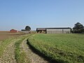
 Barns by the Track - geograph.org.uk - 1780255.jpg 2,816 × 2,112; 2.55 MB
-
 Buildings at Craven Farm near Stillington - geograph.org.uk - 4038365.jpg 1,600 × 1,200; 961 KB
-
 Crop field, Moxby Moor - geograph.org.uk - 6454082.jpg 800 × 600; 106 KB
-
 Crop field, Moxby Moor - geograph.org.uk - 6454095.jpg 640 × 480; 57 KB
-
 Driveway to Marton Park Farm - geograph.org.uk - 5917662.jpg 4,051 × 3,039; 4.13 MB
-
 Farm Road Passing Moxby Moor Farm - geograph.org.uk - 3110272.jpg 3,264 × 2,448; 1.76 MB
-
 Farm road to Moxby Farms from B1363 - geograph.org.uk - 3110277.jpg 3,264 × 2,448; 1.88 MB
-
 Farm Track near Marton Abbey - geograph.org.uk - 4965753.jpg 960 × 717; 171 KB
-
 Farmland at Moxby Moor - geograph.org.uk - 348497.jpg 640 × 480; 63 KB
-
 Field Drain Near Moxby Priory Farm - geograph.org.uk - 3110120.jpg 3,264 × 2,448; 2.27 MB
-
 Flooded layby - geograph.org.uk - 5746807.jpg 640 × 427; 203 KB
-
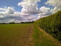 Footpath across fields - geograph.org.uk - 4965223.jpg 960 × 717; 121 KB
-
 Footpath and Barns - geograph.org.uk - 533475.jpg 640 × 359; 54 KB
-
 Foss Walk west of Marton Park - geograph.org.uk - 5939179.jpg 1,600 × 1,200; 575 KB
-
 Go directly to Gaol - geograph.org.uk - 1935328.jpg 2,667 × 2,000; 874 KB
-
 Harryfield Lane towards Tenlands - geograph.org.uk - 5938076.jpg 1,600 × 1,200; 651 KB
-
 Harryfields Lane - geograph.org.uk - 3418500.jpg 1,200 × 1,600; 758 KB
-
 Hedged farmland south-west of Marton Grange - geograph.org.uk - 4770371.jpg 1,024 × 768; 166 KB
-
 House at Moxby Priory Farm through Orchard - geograph.org.uk - 3110109.jpg 3,264 × 2,448; 2.05 MB
-
 Lay-by, Moxby Lane - geograph.org.uk - 4770161.jpg 1,024 × 768; 128 KB
-
 Looking along Moxby Lane - geograph.org.uk - 5746800.jpg 640 × 427; 196 KB
-
 Moated site at Deepley Farm - geograph.org.uk - 1935335.jpg 3,909 × 2,000; 1.25 MB
-
 Moxby Lane - geograph.org.uk - 6454115.jpg 800 × 600; 117 KB
-
 Moxby Lane - geograph.org.uk - 6454125.jpg 800 × 600; 149 KB
-
 Moxby Moor - geograph.org.uk - 5746797.jpg 640 × 427; 194 KB
-
 Near Deepley Farm - geograph.org.uk - 5359741.jpg 2,048 × 1,536; 994 KB
-
 Near Low Farm - geograph.org.uk - 5550218.jpg 2,048 × 1,536; 1.26 MB
-
 Near Marton Abbey - geograph.org.uk - 4965984.jpg 2,592 × 1,936; 1.91 MB
-
 Ordnance Survey Cut Mark - geograph.org.uk - 4029209.jpg 4,000 × 3,000; 4.39 MB
-
 Ordnance Survey Flush Bracket 2352 - geograph.org.uk - 4029217.jpg 4,000 × 3,000; 3.45 MB
-
 Overhead power lines, south of Moxby Lane - geograph.org.uk - 4770159.jpg 1,024 × 768; 132 KB
-
 Power lines crossing Mousecarrs Strome - geograph.org.uk - 4770151.jpg 1,024 × 768; 131 KB
-
 Powerlines beside Moxby Lane - geograph.org.uk - 5746796.jpg 640 × 427; 194 KB
-
 Private road to Marton Grange - geograph.org.uk - 4770368.jpg 1,024 × 768; 109 KB
-
 Pylon in crop field, Moxby Moor - geograph.org.uk - 6454119.jpg 800 × 600; 81 KB
-
 Pylon near High Inhams - geograph.org.uk - 5746803.jpg 640 × 427; 183 KB
-
 Recycling - geograph.org.uk - 533597.jpg 640 × 359; 64 KB
-
 Religious Outlook - geograph.org.uk - 212000.jpg 640 × 480; 108 KB
-
 Road at Marton Priory - geograph.org.uk - 4028854.jpg 4,000 × 3,000; 3.09 MB
-
 Road at the Gaol - geograph.org.uk - 5746869.jpg 640 × 427; 214 KB
-
 Road junction near Marton Priory - geograph.org.uk - 5746862.jpg 640 × 427; 199 KB
-
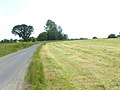
 Road near Deepley Farm - geograph.org.uk - 5746882.jpg 640 × 427; 186 KB
-
 Road near Novay Farm - geograph.org.uk - 5746873.jpg 640 × 427; 199 KB
-
 Road north of Marton Priory - geograph.org.uk - 5746867.jpg 640 × 427; 190 KB
-
 Road north of Novay Farm - geograph.org.uk - 5746875.jpg 640 × 427; 191 KB
-
 Roadside barns at Marton Priory - geograph.org.uk - 5626761.jpg 1,500 × 1,125; 1.72 MB
-
 Stubble off Moxby Lane - geograph.org.uk - 5746790.jpg 640 × 427; 236 KB
-
 The B1363 at Moxby Lane - geograph.org.uk - 2467052.jpg 800 × 600; 251 KB
-
 The Foss Walk at Marton Park - geograph.org.uk - 4038370.jpg 1,600 × 1,200; 1,001 KB
-
 The road to Helmsley - geograph.org.uk - 5917675.jpg 4,320 × 2,524; 2.01 MB
-
 The road to Marton-in-the-Forest - geograph.org.uk - 4770365.jpg 1,024 × 768; 156 KB
-
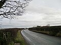
 The road to Stillington - geograph.org.uk - 4770373.jpg 1,024 × 768; 111 KB
-
 Track (bridleway) to Moxby - geograph.org.uk - 6454083.jpg 800 × 600; 118 KB
-
 Track heading towards High Inghams Farm - geograph.org.uk - 4770154.jpg 1,024 × 768; 130 KB
-
 Trees along Mousecarrs Strome - geograph.org.uk - 4770157.jpg 1,024 × 768; 154 KB
-
 Trees along Moxby Lane - geograph.org.uk - 4770143.jpg 1,024 × 768; 121 KB
-
 Wheatfield and barns. - geograph.org.uk - 533467.jpg 640 × 359; 57 KB


.jpg)


_to_Moxby_-_geograph.org.uk_-_6454083.jpg)


