Category:Massachusetts Route 38
 | number: | (thirty-eight) |
|---|---|---|
| State highways in Massachusetts: | 18 · 19 · 21 · 22 · 23 · 24 · 25 · 27 · 28 · 30 · 31 · 32 · 33 · 35 · 36 · 37 · 38 · 39 · 40 · 41 · 43 · 47 · 49 · 53 · 56 · 57 · 58 |
State highway in Massachusetts, US   | |||||
| Upload media | |||||
| Instance of | |||||
|---|---|---|---|---|---|
| Location | Massachusetts | ||||
| Transport network |
| ||||
| Owned by | |||||
| Maintained by | |||||
| Length |
| ||||
| |||||
Media relating to Massachusetts Route 38.
Media in category "Massachusetts Route 38"
The following 13 files are in this category, out of 13 total.
-
Downeaster crossing Main Street in Wilmington .webm 4 min 2 s, 1,920 × 1,080; 358.79 MB
-
 Former streetcar tracks on Mystic Avenue, April 2017.JPG 4,320 × 3,240; 4.03 MB
-
 Former Woburn Loop underpass (now Route 38 rotary), July 2015.JPG 3,604 × 2,706; 1.99 MB
-
 MA Route 38 northbound entering Dracut, MA.jpg 3,264 × 2,176; 1.32 MB
-
 MA Route 38.svg 601 × 601; 7 KB
-
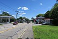
 Main Street in Wilmington - June 2008.jpg 3,072 × 2,304; 1.03 MB
-
 Main Street, Silver Lake MA.jpg 4,032 × 3,024; 4.1 MB
-
 Main Street, Tewksbury MA.jpg 5,472 × 3,648; 5.92 MB
-
 Main Street, Wilmington MA.jpg 5,472 × 3,648; 5.52 MB
-
 Massachusetts Route 38.png 1,088 × 640; 48 KB
-
 MBTA route 134 bus at North Woburn, June 2015.jpg 4,320 × 2,432; 3.14 MB
-
 MBTA route 90 bus on Mystic Avenue, April 2017.JPG 2,328 × 1,550; 651 KB
-
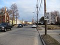 Southbound MA Route 38, Winchester MA.jpg 2,816 × 2,112; 1.8 MB

,_July_2015.JPG)


