Category:Max Gate, Dorchester
| Object location | | View all coordinates using: OpenStreetMap |
|---|
Grade I historic house n West Dorset, England, UK  | |||||
| Upload media | |||||
| Instance of | |||||
|---|---|---|---|---|---|
| Location |
| ||||
| Owned by | |||||
| Operator | |||||
| Heritage designation |
| ||||
| official website | |||||
 | |||||
Media in category "Max Gate, Dorchester"
The following 14 files are in this category, out of 14 total.
-
 Entrance to Max Gate, Dorchester - geograph.org.uk - 294843.jpg 600 × 450; 120 KB
-
 Garden of Max Gate, Dorchester.jpg 2,560 × 1,920; 1.13 MB
-
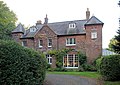
 Max Gate (9474448264).jpg 2,048 × 1,150; 799 KB
-
 Max Gate - Thomas Hardy's House - panoramio.jpg 4,320 × 3,240; 5.59 MB
-
 Max Gate Dorchester.jpg 640 × 455; 101 KB
-
 Max Gate, Dorchester, April 2015.jpg 2,560 × 1,920; 980 KB
-
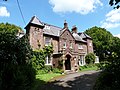
 Max Gate.jpg 3,525 × 2,592; 7.36 MB
-
 Plate 4 Max Gate, Hardy's home on the Wareham Road, near Dorchester - 1925.jpg 787 × 1,111; 157 KB
-
 Sarsen Stone 1 at Max Gate, Dorchester.jpg 2,560 × 1,920; 1.21 MB
-
 Sarsen Stone 2 at Max Gate, Dorchester.jpg 2,560 × 1,920; 1.32 MB
-
 The Prince of Wales visits Mr and Mrs Hardy at Max Gate.jpg 888 × 724; 126 KB
-
 Thomas Hardy Locations, Max Gate - geograph.org.uk - 707182.jpg 640 × 480; 135 KB
-
 Thomas Hardy's pet cemetery, Max Gate - geograph.org.uk - 294847.jpg 600 × 400; 57 KB
-
 Thomas Hardy's study, Max Gate, Dorchester.jpg 2,560 × 1,920; 764 KB


.jpg)


