Category:May 2001 in Highland (council area)
Council areas (municipalities) of Scotland: Aberdeenshire · Argyll and Bute · Edinburgh · Highland · North Ayrshire · Perth and Kinross ·
Deutsch: Bilder, die im Mai 2001 in Highland (council area) aufgenommen worden sind. Bitte beachten Sie, dass dies weder das Datum des Uploads noch das Datum des Scannens eines Fotos ist.
English: Images/pictures taken in Highland (council area) during May 2001. Note this is not the date of the upload, nor the date a photo was scanned.
Español: Fotografías o imágenes tomadas en Highland (council area) durante mayo 2001. No es la fecha de subida ni escaneo, sino la fecha en que las fotografías o imágenes se crearon.
Esperanto: Bildoj faritaj en Highland (council area) en majo 2001. Tio ne estas la dato, kiam la bildoj estis alŝutitaj aŭ skanitaj.
Français : Photographies ou images prises en Highland (council area) durant mai 2001. Ce n'est pas la date du téléchargement ou du scan.
Galego: Fotografías ou imaxes tomadas en Highland (council area) durante maio 2001. Non é a data de subida nin escaneamento, senón a data na que se crearon as fotografías ou imaxes.
Italiano: Fotografie o immagini scattate a Highland (council area) nel maggio 2001. Nota bene: la data non si riferisce né a quella di upload né a quella in cui la foto è stata digitalizzata.
Norsk bokmål: Bilder tatt i Highland (council area) i løpet av mai 2001. Merk at dette ikke er datoen for opplasting, eller når et bilde har blitt skannet.
Norsk nynorsk: Bilete teke i Highland (council area) i løpet av mai 2001. Merk at dette ikkje er datoen for opplasting, eller når eit bilete har vorte skanna.
Русский: Изображения, сделанные в Highland (council area) в течение май 2001 (не дата загрузки изображения).
Українська: Зображення, зроблені в Highland (council area) протягом травень 2001. Зауважте, що це не дата завантаження чи дата сканування фотографії.
| May 2000 | ← | May 2001 | → | May 2002 | |||||||
| Jan | Feb | Mar | Apr | May | Jun | Jul | Aug | Sep | Oct | Nov | Dec |
| 1 | 1 | 2 | 3 | 91 | 13 | 7 | 2 | 1 | 1 | 6 | 1 |
|---|---|---|---|---|---|---|---|---|---|---|---|
Media in category "May 2001 in Highland (council area)"
The following 91 files are in this category, out of 91 total.
-
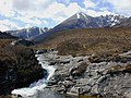
 Abhainn Coire Mhic Nobuil - geograph.org.uk - 590572.jpg 800 × 600; 288 KB
-
 Abhainn Coire Mhic Nòbuil - geograph.org.uk - 1690635.jpg 800 × 600; 221 KB
-
 An Cruinn-Leum, Applecross - geograph.org.uk - 134765.jpg 640 × 405; 48 KB
-
 An Lochan Uaine - geograph.org.uk - 1055922.jpg 800 × 600; 242 KB
-
 Ardnamurchan Lighthouse - geograph.org.uk - 961423.jpg 435 × 640; 71 KB
-
 Ardross Castle and Stags - geograph.org.uk - 1442183.jpg 640 × 387; 59 KB
-
 Ardvreck Castle - geograph.org.uk - 870772.jpg 640 × 402; 91 KB
-

-
 Aviemore from Geal Charn - geograph.org.uk - 263673.jpg 640 × 480; 34 KB
-
 Aviemore.jpg 640 × 480; 71 KB
-
 Clach Mhor and Clach Bheag na Faraid - geograph.org.uk - 878472.jpg 640 × 441; 42 KB
-
 Coastal Erosion, Traigh Bad na Baighe - geograph.org.uk - 872300.jpg 452 × 640; 157 KB
-
 Coire na Cloiche - geograph.org.uk - 263680.jpg 640 × 480; 53 KB
-
 Eas a'Chual Aluinn - geograph.org.uk - 868614.jpg 429 × 640; 105 KB
-
 East ridge of Sgurr nan Eugallt - geograph.org.uk - 25127.jpg 640 × 395; 71 KB
-
 Eastern approach to Baosbheinn - geograph.org.uk - 1055903.jpg 640 × 418; 116 KB
-

-
 Fishing Bothy, River Laxford - geograph.org.uk - 870737.jpg 640 × 412; 96 KB
-
 Garbh Choire.jpg 640 × 414; 71 KB
-
 Gateway to Arkle - geograph.org.uk - 870847.jpg 640 × 426; 127 KB
-
 Geal Charn Beag - geograph.org.uk - 263691.jpg 640 × 480; 37 KB
-
 Glen Barrisdale - geograph.org.uk - 25130.jpg 640 × 371; 49 KB
-
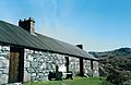
 Glendhu house - geograph.org.uk - 868562.jpg 640 × 426; 80 KB
-
 Glendhu house - geograph.org.uk - 868569.jpg 640 × 426; 107 KB
-
 In Gleann Dubh - geograph.org.uk - 869847.jpg 471 × 640; 108 KB
-
 Island in Loch Uidh na h-Iarna - geograph.org.uk - 868675.jpg 640 × 364; 75 KB
-
 Kinlochbervie harbour - geograph.org.uk - 878512.jpg 434 × 640; 113 KB
-
 Liathach from the north - geograph.org.uk - 1690654.jpg 800 × 600; 257 KB
-
 Loch an Eoin - geograph.org.uk - 588695.jpg 800 × 600; 200 KB
-
 Loch Dughail - geograph.org.uk - 878376.jpg 640 × 444; 82 KB
-
 Loch Glendhu - geograph.org.uk - 868585.jpg 640 × 428; 102 KB
-
 Loch Insh from "the ridge" - geograph.org.uk - 263677.jpg 640 × 480; 62 KB
-
 Loch Torridon from Annat - geograph.org.uk - 1055915.jpg 800 × 600; 232 KB
-
 Lochan Domhain - geograph.org.uk - 1690686.jpg 800 × 600; 275 KB
-

-
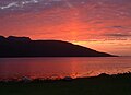 Lochbroom sunset - geograph.org.uk - 1108266.jpg 640 × 462; 48 KB
-
 M.v.Statesman landing at Kylesku - geograph.org.uk - 868604.jpg 640 × 426; 67 KB
-
 MV.Hector at Tanera Beg - geograph.org.uk - 878444.jpg 640 × 453; 78 KB
-
 New jetty at Kylesku - geograph.org.uk - 868595.jpg 640 × 426; 70 KB
-
 Old bothy Loch Stack - geograph.org.uk - 878523.jpg 640 × 452; 76 KB
-
 On the slopes of Geal Charn - geograph.org.uk - 263688.jpg 640 × 480; 34 KB
-
 Pass south of Meall Mor, Monadhliath. - geograph.org.uk - 25827.jpg 640 × 410; 59 KB
-
 Sandy beach at An Fharaid - geograph.org.uk - 878498.jpg 640 × 445; 35 KB
-
 Sango Bay, Sutherland - geograph.org.uk - 872276.jpg 640 × 421; 84 KB
-
 Sea cliffs north of Stoer Lighthouse - geograph.org.uk - 878049.jpg 640 × 439; 54 KB
-
 Sgoran dubh Mor - geograph.org.uk - 263669.jpg 640 × 480; 71 KB
-

-
 Southern Spey Valley - geograph.org.uk - 263671.jpg 640 × 480; 46 KB
-
 Sparsely vegetated slopes north east of Baosbhein (geograph 649830).jpg 800 × 537; 188 KB
-
 Stalkers path to Loch na Tuadh - geograph.org.uk - 880065.jpg 640 × 459; 110 KB
-
 Stoer Lighthouse - geograph.org.uk - 878047.jpg 640 × 440; 90 KB
-
 Suileag Bothy - geograph.org.uk - 1210987.jpg 640 × 415; 68 KB
-
 The Allt Toll a' Mhadaidh - geograph.org.uk - 1055911.jpg 800 × 573; 292 KB
-
 The beach at Oldshoremore - geograph.org.uk - 878518.jpg 640 × 429; 76 KB
-
 The Bealach a Bhuirich - geograph.org.uk - 878668.jpg 640 × 427; 99 KB
-
 The Cape Wrath Hotel - geograph.org.uk - 878505.jpg 640 × 452; 75 KB
-
 The Garbh Allt - geograph.org.uk - 902463.jpg 800 × 600; 251 KB
-
 The Glendhu Forest - geograph.org.uk - 870088.jpg 640 × 436; 99 KB
-
 The Inner Sound from Applecross - geograph.org.uk - 134762.jpg 640 × 425; 102 KB
-
 The Loch Glendhu path - geograph.org.uk - 869838.jpg 640 × 423; 123 KB
-
 The Nethy by Bynack Stable - geograph.org.uk - 589836.jpg 800 × 600; 223 KB
-
 The path to Eas a Chual Aluinn - geograph.org.uk - 912994.jpg 640 × 439; 106 KB
-

-
 Tigh Phuirt road junction - geograph.org.uk - 961416.jpg 608 × 410; 52 KB
-
 Timber Barge - geograph.org.uk - 84073.jpg 640 × 385; 146 KB
-
 Unapool House, Kylesku - geograph.org.uk - 870815.jpg 640 × 427; 108 KB
-
 Urquhart Castle from the Loch - geograph.org.uk - 60035.jpg 530 × 350; 22 KB
-
 View east from the Bealach na Lice - geograph.org.uk - 588693.jpg 800 × 600; 195 KB
-
-
 View southeast from Baosbheinn - geograph.org.uk - 1055906.jpg 640 × 480; 98 KB
-

-
 View towards Bynack More - geograph.org.uk - 902502.jpg 800 × 600; 201 KB
-
 View towards Coire na Caime - geograph.org.uk - 1690653.jpg 800 × 549; 237 KB
-
 Waterfall in Gleann Leireag - geograph.org.uk - 868670.jpg 640 × 427; 91 KB
-

-
 Waterfall on the Garbh Allt - geograph.org.uk - 902434.jpg 640 × 480; 135 KB
-
 West of the Torridon road - geograph.org.uk - 588691.jpg 800 × 600; 161 KB
-
 Bendronaig Lodge - geograph.org.uk - 105627.jpg 640 × 429; 71 KB
-
 Coireshubh - geograph.org.uk - 25122.jpg 640 × 414; 54 KB
-
 Headwaters of the Allt Lairig Eilde - geograph.org.uk - 641766.jpg 640 × 441; 91 KB
-
 Lochan Dubh - geograph.org.uk - 263694.jpg 640 × 480; 57 KB
-
 North west ridge of Baosbheinn - geograph.org.uk - 588700.jpg 800 × 600; 252 KB
-
 On the moors above Scoraig - geograph.org.uk - 88391.jpg 640 × 461; 115 KB
-
 Shieling in Coire Mhic Nobuil - geograph.org.uk - 589777.jpg 640 × 480; 133 KB
-
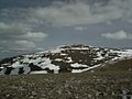
 Slopes north east of Baosbheinn - geograph.org.uk - 588697.jpg 800 × 600; 191 KB
-
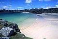
 The beach near Big Sand - geograph.org.uk - 589828.jpg 640 × 480; 57 KB
-
 The path from Badralloch to Scoraig - geograph.org.uk - 88386.jpg 640 × 459; 81 KB
-

-
 The south east top of Baosbheinn - geograph.org.uk - 588698.jpg 640 × 480; 80 KB
-
 The south side of Coire Mhic Nobuil - geograph.org.uk - 589799.jpg 800 × 600; 264 KB
-
 View from Sgurr Dubh - geograph.org.uk - 25133.jpg 640 × 392; 53 KB


.jpg)


