Category:May 2005 in Lincolnshire
Deutsch: Bilder, die im Mai 2005 in Lincolnshire aufgenommen worden sind. Bitte beachten Sie, dass dies weder das Datum des Uploads noch das Datum des Scannens eines Fotos ist.
English: Images/pictures taken in Lincolnshire during May 2005. Note this is not the date of the upload, nor the date a photo was scanned.
Español: Fotografías o imágenes tomadas en Lincolnshire durante mayo 2005. No es la fecha de subida ni escaneo, sino la fecha en que las fotografías o imágenes se crearon.
Esperanto: Bildoj faritaj en Lincolnshire en majo 2005. Tio ne estas la dato, kiam la bildoj estis alŝutitaj aŭ skanitaj.
Français : Photographies ou images prises en Lincolnshire durant mai 2005. Ce n'est pas la date du téléchargement ou du scan.
Galego: Fotografías ou imaxes tomadas en Lincolnshire durante maio 2005. Non é a data de subida nin escaneamento, senón a data na que se crearon as fotografías ou imaxes.
Italiano: Fotografie o immagini scattate a Lincolnshire nel maggio 2005. Nota bene: la data non si riferisce né a quella di upload né a quella in cui la foto è stata digitalizzata.
Norsk bokmål: Bilder tatt i Lincolnshire i løpet av mai 2005. Merk at dette ikke er datoen for opplasting, eller når et bilde har blitt skannet.
Norsk nynorsk: Bilete teke i Lincolnshire i løpet av mai 2005. Merk at dette ikkje er datoen for opplasting, eller når eit bilete har vorte skanna.
Русский: Изображения, сделанные в Lincolnshire в течение май 2005 (не дата загрузки изображения).
Українська: Зображення, зроблені в Lincolnshire протягом травень 2005. Зауважте, що це не дата завантаження чи дата сканування фотографії.
| May 2004 | ← | May 2005 | → | May 2006 | |||||||
| Jan | Feb | Mar | Apr | May | Jun | Jul | Aug | Sep | Oct | Nov | Dec |
| 7 | 11 | 12 | 27 | 83 | 16 | 17 | 45 | 47 | 29 | 23 | 104 |
|---|---|---|---|---|---|---|---|---|---|---|---|
Subcategories
This category has the following 2 subcategories, out of 2 total.
1
2
Media in category "May 2005 in Lincolnshire"
The following 81 files are in this category, out of 81 total.
-
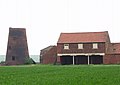 Barnetby le Wold Mill.jpg 640 × 452; 36 KB
-
 St Mary's, Barnetby Le Wold - geograph.org.uk - 6470.jpg 640 × 480; 111 KB
-
 St Marys - geograph.org.uk - 6536.jpg 640 × 480; 67 KB
-
 Barnetby "East" - geograph.org.uk - 6564.jpg 640 × 427; 53 KB
-
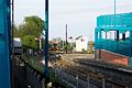
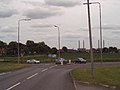
 Barnetby Station - geograph.org.uk - 6563.jpg 640 × 431; 45 KB
-
 May Day, Burgate - geograph.org.uk - 54044.jpg 640 × 427; 145 KB
-
 Barton Haven - geograph.org.uk - 6810.jpg 640 × 402; 51 KB
-
 Elsham Hill - geograph.org.uk - 6681.jpg 380 × 480; 24 KB
-
 All Saints Church - geograph.org.uk - 6696.jpg 640 × 468; 56 KB
-
 SSE from Coleby - geograph.org.uk - 9906.jpg 640 × 480; 97 KB
-

-
 Covenham Community Room - geograph.org.uk - 147968.jpg 640 × 480; 99 KB
-
 Willow Stump - geograph.org.uk - 10780.jpg 640 × 480; 120 KB
-
 Alkborough Church - geograph.org.uk - 10287.jpg 640 × 480; 97 KB
-
 Kell Well - geograph.org.uk - 10477.jpg 640 × 453; 183 KB
-
 Burton Stather water tower - geograph.org.uk - 10301.jpg 640 × 480; 57 KB
-
 Water Tower, Gainsborough.jpg 962 × 720; 264 KB
-
 Haymaker - geograph.org.uk - 10838.jpg 640 × 480; 74 KB
-
 Horkstow Bridge - geograph.org.uk - 10832.jpg 640 × 480; 76 KB
-
 Horkstow Church - geograph.org.uk - 10856.jpg 640 × 480; 121 KB
-
 Horkstow Village - geograph.org.uk - 10839.jpg 640 × 480; 110 KB
-
 Hope and Anchor - geograph.org.uk - 10849.jpg 640 × 480; 80 KB
-
 Humber - geograph.org.uk - 10857.jpg 640 × 480; 49 KB
-
 Lock Gates - geograph.org.uk - 10847.jpg 640 × 480; 91 KB
-
 Winteringham Grange - geograph.org.uk - 10851.jpg 640 × 480; 79 KB
-
 Dragonby - geograph.org.uk - 11059.jpg 640 × 480; 90 KB
-
 Crosby Hotel - geograph.org.uk - 11057.jpg 640 × 480; 77 KB
-
 Cemetery House - geograph.org.uk - 11065.jpg 640 × 480; 102 KB
-
 Dents Cottage - geograph.org.uk - 11066.jpg 640 × 480; 116 KB
-
 Winterton Cemetery - geograph.org.uk - 11064.jpg 640 × 480; 105 KB
-
 Sawcliffe Farm - geograph.org.uk - 11243.jpg 640 × 480; 79 KB
-
 Scunthorpe Bus Station - geograph.org.uk - 314156.jpg 640 × 480; 73 KB
-
 A rapeseed field in the Lincolnshire Vales, South Kesteven, England 1.jpg 2,560 × 1,920; 5.61 MB
-
 A rapeseed field in the Lincolnshire Vales, South Kesteven, England 2.jpg 2,560 × 1,920; 5 MB
-
 A country lane in the Lincolnshire Vales, South Kesteven, England.jpg 2,560 × 1,920; 4.71 MB
-
 Horkstow Bridge - geograph.org.uk - 10846.jpg 640 × 480; 81 KB
-
 Ferriby lock gates - geograph.org.uk - 10848.jpg 640 × 480; 80 KB
-
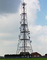
 Twin Powers - geograph.org.uk - 10845.jpg 640 × 480; 99 KB
-
 Setaside - geograph.org.uk - 11711.jpg 640 × 480; 107 KB
-
 Grantham - canal obliterated - geograph.org.uk - 137287.jpg 640 × 480; 148 KB
-
 Old Cliff Farm - geograph.org.uk - 11718.jpg 640 × 480; 97 KB
-
 A view west, Woodnook Valley, Little Ponton, Lincolnshire, England 03.jpg 2,560 × 1,920; 3.79 MB
-
 A view west, Woodnook Valley, Little Ponton, Lincolnshire, England 04.jpg 2,560 × 1,920; 3.1 MB
-
 The Wheatsheaf Inn - geograph.org.uk - 39786.jpg 640 × 480; 133 KB
-
 Barrows - geograph.org.uk - 12756.jpg 640 × 480; 81 KB
-
 North Lincolnshire Museum-by-fred-roberts.jpg 640 × 480; 110 KB
-
 Roman Floor - geograph.org.uk - 12820.jpg 640 × 480; 99 KB
-
 Romans - geograph.org.uk - 12759.jpg 640 × 480; 100 KB
-
 Main Drain - geograph.org.uk - 67684.jpg 640 × 480; 112 KB
-
 Burnham - Phone Box - geograph.org.uk - 66898.jpg 640 × 480; 222 KB
-
 Old Mill Road - geograph.org.uk - 13696.jpg 640 × 480; 58 KB
-
 A group of cows - Woodnook Valley, Lincolnshire, Little Ponton, England.jpg 2,560 × 1,920; 2.96 MB
-
 A view east, Woodnook Valley, Little Ponton, Lincolnshire, England 01.jpg 2,448 × 1,660; 2.69 MB
-
 A view south, Woodnook Valley, Little Ponton, Lincolnshire, England.jpg 2,560 × 1,920; 4.56 MB
-
 A view west, Woodnook Valley, Little Ponton, Lincolnshire, England 01.jpg 1,920 × 2,560; 4.55 MB
-
 A view west, Woodnook Valley, Little Ponton, Lincolnshire, England 02.jpg 2,560 × 1,920; 4.65 MB
-
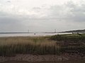
 Alkborough Flats and Trent Falls - geograph.org.uk - 10926.jpg 640 × 480; 54 KB
-
 St Mary's Church, Broughton, Lincolnshire.jpg 640 × 480; 134 KB
-
 Clearly Signposted - geograph.org.uk - 11689.jpg 640 × 480; 81 KB
-
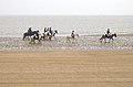 Cleethorpes Beach - geograph.org.uk - 61145.jpg 640 × 424; 79 KB
-
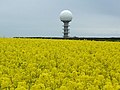
 Colourful Symmetry.jpg 4,800 × 3,929; 12.65 MB
-
 Humber Bridge - geograph.org.uk - 16940.jpg 640 × 479; 97 KB
-
 Island House - geograph.org.uk - 10065.jpg 640 × 480; 59 KB
-
 Ministry of Defence Road Sign.jpg 1,578 × 602; 433 KB
-
 NE to the Humber from Coleby - geograph.org.uk - 9907.jpg 640 × 480; 63 KB
-
 Roxby Landfill - geograph.org.uk - 11712.jpg 640 × 480; 97 KB
-
 SE8922 - geograph.org.uk - 10819.jpg 640 × 480; 98 KB
-
 Source of the Humber - geograph.org.uk - 10291.jpg 640 × 480; 55 KB
-
 Station Yard - geograph.org.uk - 6565.jpg 640 × 444; 46 KB
-

-
 Walk House - geograph.org.uk - 11825.jpg 640 × 480; 107 KB
-
 Whitton Scalp - geograph.org.uk - 11692.jpg 640 × 480; 90 KB
-
 Wolds Top.jpg 640 × 480; 90 KB
-
 Almost Garthorpe - geograph.org.uk - 11374.jpg 640 × 480; 53 KB
-
 Cringlebeck Farm - geograph.org.uk - 11062.jpg 640 × 480; 72 KB
-
 Highfield Farm - geograph.org.uk - 11830.jpg 640 × 480; 137 KB
-
 Leys Lane - geograph.org.uk - 11072.jpg 640 × 480; 97 KB
-
 No Through Road - geograph.org.uk - 11704.jpg 640 × 480; 162 KB
-
 Skippingdale - geograph.org.uk - 11349.jpg 640 × 480; 77 KB
-
 The Buttonhook - geograph.org.uk - 20644.jpg 640 × 480; 49 KB
-
 Warp Land - geograph.org.uk - 11218.jpg 640 × 480; 82 KB


