Category:May 2006 in Utah
English: Images/pictures taken in Utah during May 2006. Note this is not the date of the upload, nor the date a photo was scanned.
States of the United States: Alabama · Alaska · Arizona · Arkansas · California · Colorado · Connecticut · Delaware · Florida · Georgia · Hawaii · Idaho · Illinois · Indiana · Iowa · Kentucky · Louisiana · Maine · Maryland · Massachusetts · Michigan · Minnesota · Missouri · Montana · Nevada · New Hampshire · New Jersey · New Mexico · New York · North Carolina · Ohio · Oklahoma · Oregon · Pennsylvania · Rhode Island · South Dakota · Tennessee · Texas · Utah · Virginia · Washington · Wisconsin – Washington, D.C.
| May 2005 | ← | May 2006 | → | May 2007 | |||||||||
| Jan | Feb | Mar | Apr | May | Jun | Jul | Aug | Sep | Oct | Nov | Dec | ||
| ← | 13 | 44 | 19 | 49 | 72 | 28 | 45 | 47 | 35 | 44 | 19 | 8 | → |
|---|---|---|---|---|---|---|---|---|---|---|---|---|---|
Media in category "May 2006 in Utah"
The following 72 files are in this category, out of 72 total.
-
 Ant Hill Zion.jpg 1,488 × 1,035; 554 KB
-
 Barrel Cactus Flowers (3684305293).jpg 1,600 × 1,067; 448 KB
-
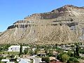
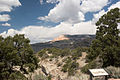
 Book Cliffs above Helper, Utah.jpg 3,264 × 2,448; 1.83 MB
-
 BookCliffsHelper.jpg 216 × 162; 27 KB
-
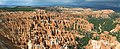 Bryce Canyon Amphitheater Hoodoos Panorama.jpg 3,827 × 1,570; 5.12 MB
-
 Bryce Canyon Hoodoos 4 edit.JPG 1,420 × 1,893; 1.78 MB
-
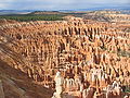 Bryce Canyon Hoodoos Amphitheater 2.jpg 2,272 × 1,704; 2.35 MB
-
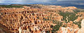 Bryce Canyon Hoodoos Amphitheater Panorama.jpg 5,196 × 2,039; 7.85 MB
-
 Bryce Canyon Hoodoos Amphitheater.jpg 2,272 × 1,704; 2.13 MB
-
 Bryce Canyon Hoodoos at eye level.jpg 2,272 × 1,704; 833 KB
-
 Bryce Canyon Hoodoos.jpg 2,272 × 1,704; 2.2 MB
-
 Calf Creek from Rt 12 (3685122410).jpg 1,600 × 1,067; 557 KB
-
 Capitol Reef NP, Burr Trail Road (3685114454).jpg 1,600 × 1,067; 585 KB
-
 Capitol Reef NP, Notom Bullfrog Road, Oyster Shell Reef (3685114154).jpg 1,600 × 1,067; 514 KB
-
 Capitol Reef NP, Strike Valley Overlook, looking north (3684303831).jpg 1,600 × 1,067; 699 KB
-
 Church Rock Utah 1.jpg 2,272 × 1,704; 638 KB
-
 Commercial truck travelling on I-70 in Utah.jpg 1,600 × 1,200; 229 KB
-
 Cottonwood Road (3685109060).jpg 1,600 × 1,067; 709 KB
-
 CottonwoodCanyon5506.JPG 2,048 × 1,536; 1.41 MB
-
 CottonwoodCanyonRdNorth5532.JPG 2,048 × 1,536; 1.39 MB
-
 Del.Arch2.B0171.jpg 2,791 × 2,155; 4.55 MB
-
 Fremont Indian State Park behind the Visitors' Center.jpg 2,576 × 1,932; 1.34 MB
-
 GrosvenorArch5539.JPG 2,048 × 1,536; 1.33 MB
-
 He Laid the Foundation of the Earth.jpg 2,048 × 1,360; 1.73 MB
-
 HeberCKimballGraveSouth.jpg 1,932 × 2,576; 1.41 MB
-
 Hickman Bridge Capitol Reef National Park USA.jpg 3,016 × 2,008; 6.96 MB
-
 HuntSceneNMC.JPG 2,288 × 1,712; 846 KB
-
 I-70 through Utah (14 February 2008) (4).jpg 1,600 × 1,200; 278 KB
-
 Inner gorge of Escalante river.jpg 1,944 × 2,592; 1.75 MB
-
 Interstate 70 through Utah.jpg 2,272 × 1,567; 514 KB
-
 Kodachrome Basin State Park - Panorama Trail (3685110742).jpg 1,600 × 1,200; 533 KB
-
 Kodachrome State Park (3684298567).jpg 1,600 × 1,067; 681 KB
-
 Kodachrome State Park (3685109868).jpg 1,600 × 1,067; 702 KB
-
 Kodachrome State Park (3685110448).jpg 1,200 × 1,600; 415 KB
-
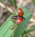 LadybugWingsClose.jpg 560 × 595; 76 KB
-
 Little Death Hollow Trailhead (3685115826).jpg 1,600 × 1,067; 665 KB
-
 Little Death Hollow, Petroglyphs (3684304713).jpg 1,600 × 1,067; 629 KB
-
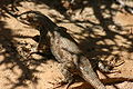 Lizard near Hickman Bridge.jpg 2,048 × 1,360; 1.7 MB
-
 May 27 2006 Red Canyon UT USA 2.jpg 2,048 × 1,536; 1.58 MB
-
 May 27 2006 Red Canyon UT USA.jpg 2,048 × 1,536; 1.86 MB
-
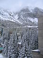
 May 28 2006 Snowbird UT USA inside lodge.jpg 1,536 × 2,048; 1.61 MB
-
 May 28 2006 Snowbird UT USA outside forest.jpg 1,536 × 2,048; 1.82 MB
-
 Mountains in Zion National Park, Utah.jpg 2,272 × 1,704; 3.03 MB
-
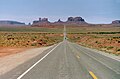 Navajoland - U.S. Route 163 in Monument Valley.jpg 2,323 × 1,531; 2.25 MB
-
 Panoramic view from Observation Point, Zion NP.jpg 16,522 × 1,874; 7.6 MB
-
 Paria Box - (greg-willis.com) - panoramio - Greg Willis.jpg 1,000 × 667; 333 KB
-
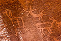
 Petroglyphs - (greg-willis.com) - panoramio.jpg 1,000 × 667; 342 KB
-
 Powell Point (3685122652).jpg 1,600 × 1,067; 448 KB
-
 Powell Point from Bryce Canyon (3685122940).jpg 1,600 × 946; 179 KB
-
 R27182818 escalante 0378.jpg 1,944 × 2,592; 1.56 MB
-
 Red Cliff in Zion National Park.jpg 2,198 × 1,590; 2.85 MB
-
 Red Cliff in Zion National Park2.jpg 2,198 × 1,590; 2.58 MB
-
 Route 12 between Escalante and Boulder (3684300429).jpg 1,600 × 1,067; 614 KB
-
 SanRafaelReefUT.jpg 918 × 600; 130 KB
-
 Springdale (3684312119).jpg 1,600 × 1,067; 552 KB
-
 Squaretower.JPG 2,560 × 1,920; 1.02 MB
-
 Squirrel Feeding on Pinecone while Balancing on Tree Trunk.jpg 2,048 × 1,360; 1.24 MB
-
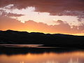 StrawResSunset.JPG 2,288 × 1,712; 769 KB
-
 The Cockscomb & Cottonwood Road (3685108778).jpg 1,600 × 1,067; 617 KB
-
 The Straight Cliffs from Escalante (3684299855).jpg 1,600 × 1,067; 622 KB
-
 Time-Honored Rockfall.jpg 2,048 × 1,360; 2.93 MB
-
 Town of Escalante (3685111734).jpg 1,200 × 1,600; 367 KB
-
 Utah Lake by boat.jpg 1,668 × 1,113; 384 KB
-
 Utah State Rt 12 near Red Canyon.jpg 3,016 × 2,008; 6.76 MB
-
 Utah01.JPG 1,600 × 1,200; 275 KB
-
 Utah08.JPG 1,600 × 1,200; 222 KB
-
 Ute Petroglyphs in Arches National Park.jpg 2,272 × 1,704; 1.5 MB
-
 View from La Sal Mountain Overlook in Arches National Park.jpg 15,989 × 1,057; 4.32 MB
-
 WB-47E.jpg 600 × 336; 227 KB
-
 Western terminus of I-70 at Cove Fort, Utah.jpg 1,600 × 1,056; 274 KB
-
 Wilson Arch 1.jpg 2,272 × 1,704; 909 KB
-
 Zion Road (3684311809).jpg 1,067 × 1,600; 531 KB

.jpg)


.jpg)
.jpg)
.jpg)
.jpg)


.jpg)


_(4).jpg)


.jpg)
.jpg)
.jpg)
.jpg)

.jpg)
.jpg)


_-_panoramio_-_Greg_Willis.jpg)
_-_panoramio.jpg)
.jpg)
.jpg)


.jpg)

.jpg)


.jpg)
.jpg)

.jpg)


.jpg)