Category:May 2007 in Cornwall
Deutsch: Bilder, die im Mai 2007 in Cornwall aufgenommen worden sind. Bitte beachten Sie, dass dies weder das Datum des Uploads noch das Datum des Scannens eines Fotos ist.
English: Images/pictures taken in Cornwall during May 2007. Note this is not the date of the upload, nor the date a photo was scanned.
Español: Fotografías o imágenes tomadas en Cornwall durante mayo 2007. No es la fecha de subida ni escaneo, sino la fecha en que las fotografías o imágenes se crearon.
Esperanto: Bildoj faritaj en Cornwall en majo 2007. Tio ne estas la dato, kiam la bildoj estis alŝutitaj aŭ skanitaj.
Français : Photographies ou images prises en Cornwall durant mai 2007. Ce n'est pas la date du téléchargement ou du scan.
Galego: Fotografías ou imaxes tomadas en Cornwall durante maio 2007. Non é a data de subida nin escaneamento, senón a data na que se crearon as fotografías ou imaxes.
Italiano: Fotografie o immagini scattate a Cornwall nel maggio 2007. Nota bene: la data non si riferisce né a quella di upload né a quella in cui la foto è stata digitalizzata.
Norsk bokmål: Bilder tatt i Cornwall i løpet av mai 2007. Merk at dette ikke er datoen for opplasting, eller når et bilde har blitt skannet.
Norsk nynorsk: Bilete teke i Cornwall i løpet av mai 2007. Merk at dette ikkje er datoen for opplasting, eller når eit bilete har vorte skanna.
Русский: Изображения, сделанные в Cornwall в течение май 2007 (не дата загрузки изображения).
Українська: Зображення, зроблені в Cornwall протягом травень 2007. Зауважте, що це не дата завантаження чи дата сканування фотографії.
| May 2006 | ← | May 2007 | → | May 2008 | |||||||
| Jan | Feb | Mar | Apr | May | Jun | Jul | Aug | Sep | Oct | Nov | Dec |
| 14 | 51 | 108 | 101 | 97 | 117 | 136 | 164 | 104 | 31 | 23 | 26 |
|---|---|---|---|---|---|---|---|---|---|---|---|
Media in category "May 2007 in Cornwall"
The following 97 files are in this category, out of 97 total.
-
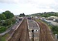 Par railway station 1.JPG 1,843 × 1,310; 1.51 MB
-
 Par Viaduct 1.JPG 2,160 × 1,440; 891 KB
-
 Par railway station 2.JPG 2,160 × 1,440; 1.34 MB
-
 A Country Lane - geograph.org.uk - 439440.jpg 640 × 427; 126 KB
-
 A Farmtrack ford - geograph.org.uk - 450091.jpg 640 × 427; 143 KB
-
 A ford on a road through woodland - geograph.org.uk - 426925.jpg 640 × 427; 141 KB
-
 A ripening field of barley - geograph.org.uk - 440092.jpg 640 × 480; 52 KB
-
 A3078 near Freewater - geograph.org.uk - 442318.jpg 640 × 480; 110 KB
-
 A394 at Longdowns - geograph.org.uk - 426986.jpg 640 × 480; 86 KB
-
 A394 Helston to Penzance road - geograph.org.uk - 430691.jpg 640 × 480; 73 KB
-
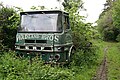 Abandoned Lorry on a Farm Track - geograph.org.uk - 450074.jpg 640 × 427; 128 KB
-
 AEC Matador 4X4 - geograph.org.uk - 430905.jpg 640 × 480; 116 KB
-
 Alexandra Rd, B3276. - geograph.org.uk - 425763.jpg 640 × 408; 77 KB
-
 All alone at Kenneggy Cove - geograph.org.uk - 498915.jpg 640 × 426; 120 KB
-
 Ancient Cross and High Hall - geograph.org.uk - 437316.jpg 475 × 640; 97 KB
-
-
 Barracks, Pendennis Castle - geograph.org.uk - 534537.jpg 640 × 427; 60 KB
-
 Bedruthan Steps (496568718).jpg 2,048 × 1,371; 735 KB
-
 Beeny Cliff - geograph.org.uk - 437370.jpg 640 × 480; 86 KB
-
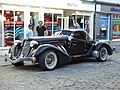 Black beauty (487064516).jpg 2,848 × 2,136; 2.13 MB
-
 Boats at the jetty, Sennen Cove - geograph.org.uk - 493101.jpg 426 × 640; 134 KB
-
 Boscastle flood.jpg 2,304 × 1,728; 2.07 MB
-
 Branch line - geograph.org.uk - 1724774.jpg 640 × 480; 78 KB
-
 Bringing back the catch - geograph.org.uk - 449467.jpg 640 × 426; 62 KB
-
 British Isles rural and coastal Cornwall 2007 (496588888).jpg 2,048 × 1,371; 727 KB
-
 British Isles rural and coastal Cornwall 2007 (496593678).jpg 2,048 × 1,371; 667 KB
-
 British Isles rural and coastal Cornwall 2007 (496620919).jpg 2,048 × 1,371; 647 KB
-
 British Isles urban Cornwall 2007 (496602270).jpg 2,048 × 1,371; 540 KB
-
 British Isles urban Cornwall 2007 (496602762).jpg 2,048 × 1,371; 543 KB
-
 Carbis Bay station - geograph.org.uk - 1724723.jpg 640 × 480; 104 KB
-
 Carn Euny ancient village - geograph.org.uk - 649875.jpg 640 × 480; 72 KB
-
 Castledore - geograph.org.uk - 434068.jpg 640 × 480; 111 KB
-
 Cattle on the Tamar Flood Plain - geograph.org.uk - 438275.jpg 640 × 426; 97 KB
-
 Choppy seas at Penzance - geograph.org.uk - 449463.jpg 640 × 400; 57 KB
-
 Churchyard at St. Crida's - geograph.org.uk - 430909.jpg 640 × 480; 124 KB
-

-
 Cold Northcott tea rooms - geograph.org.uk - 437329.jpg 640 × 480; 117 KB
-
 Cornish Bricks The Digey St Ives - geograph.org.uk - 4154894.jpg 731 × 1,024; 491 KB
-
 Cornwall 2007 (496588330).jpg 2,048 × 1,371; 452 KB
-
 Cornwall 2007 (496618963).jpg 1,371 × 2,048; 929 KB
-
 Cornwall 2007 (496623155).jpg 2,048 × 1,371; 819 KB
-
 Cornwall 2007 (496625825).jpg 2,048 × 1,371; 602 KB
-
 Cornwall 2007 Street type (496592980).jpg 2,048 × 1,371; 656 KB
-
 Cottage Wall Virgin St St Ives - geograph.org.uk - 2773294.jpg 427 × 640; 468 KB
-
 Crossroad near Pendoggett - geograph.org.uk - 448785.jpg 640 × 480; 101 KB
-
 Dinham's Bridge - geograph.org.uk - 448641.jpg 640 × 480; 147 KB
-
 Duchy Of Cornwall Nurseries - geograph.org.uk - 430977.jpg 640 × 480; 131 KB
-
 Dunheved Cross - geograph.org.uk - 429070.jpg 458 × 640; 119 KB
-
 Ex Flour Mill - geograph.org.uk - 429005.jpg 640 × 427; 103 KB
-
 Farmland Job's Tenement - geograph.org.uk - 448736.jpg 640 × 480; 117 KB
-
 Footpath to The Warren Car Park St Ives - geograph.org.uk - 2773278.jpg 427 × 640; 407 KB
-
 Freight Train near Lostwithiel - geograph.org.uk - 2999474.jpg 1,200 × 810; 1.14 MB
-
 Granite cottage wall The Digey St Ives - geograph.org.uk - 2774339.jpg 427 × 640; 502 KB
-
 Grassland and Woodland - geograph.org.uk - 442333.jpg 640 × 480; 100 KB
-
 Herringbone dry stone wall - geograph.org.uk - 443265.jpg 640 × 480; 102 KB
-
 Housing Terrace on Dunheved Road - geograph.org.uk - 429114.jpg 640 × 427; 93 KB
-
 Lane Park - geograph.org.uk - 448776.jpg 640 × 480; 168 KB
-
 Lane up to Kitts Hill - geograph.org.uk - 449453.jpg 640 × 480; 136 KB
-

-

-

-
 Lostwithiel Station - geograph.org.uk - 2999397.jpg 1,200 × 813; 1.05 MB
-
 Luckett Post Office - geograph.org.uk - 450170.jpg 640 × 427; 127 KB
-
 Mousehole boats (496584382).jpg 2,048 × 1,371; 500 KB
-
 Mousehole harbour (496585272).jpg 2,048 × 1,371; 650 KB
-

-
 Newquay Bay - geograph.org.uk - 433762.jpg 640 × 427; 81 KB
-
 Old halt on a disused railway - geograph.org.uk - 444921.jpg 640 × 480; 99 KB
-
 Pendoggett - geograph.org.uk - 448792.jpg 640 × 480; 122 KB
-
 Porthmeor Beach St Ives - geograph.org.uk - 2774325.jpg 427 × 640; 223 KB
-
 Porthminster Beach St Ives - geograph.org.uk - 2774330.jpg 427 × 640; 213 KB
-
 Postbox at Landlake Cross - geograph.org.uk - 428928.jpg 427 × 640; 151 KB
-
 Put money in the slot (496627525).jpg 1,371 × 2,048; 846 KB
-
 Pylons along the River Allen valley - geograph.org.uk - 448661.jpg 640 × 480; 132 KB
-
 Road junction on the B3289 - geograph.org.uk - 443052.jpg 640 × 480; 75 KB
-
 Rose Lane St Ives - geograph.org.uk - 2774317.jpg 427 × 640; 331 KB
-

-
 Sennen Cove - geograph.org.uk - 449460.jpg 640 × 426; 88 KB
-
 Small Ford by Watergate Wood - geograph.org.uk - 426061.jpg 640 × 427; 125 KB
-
 Smeaton Pier Head and Light St Ives - geograph.org.uk - 2774331.jpg 640 × 427; 230 KB
-
 St Ives Bay Line 2007-05-20.jpg 2,622 × 1,748; 3.73 MB
-
 St Kew Sign - geograph.org.uk - 448744.jpg 480 × 640; 131 KB
-
 The Earl of St Vincent - geograph.org.uk - 448565.jpg 640 × 480; 112 KB
-
 The ford at St Lawrence - geograph.org.uk - 427207.jpg 640 × 427; 148 KB
-
 The inner harbour, Penzance - geograph.org.uk - 450052.jpg 640 × 425; 67 KB
-
 The Old Post Office Tintagel - geograph.org.uk - 2395828.jpg 3,008 × 2,000; 1.47 MB
-
 The Village Pump - geograph.org.uk - 428118.jpg 640 × 427; 75 KB
-
 Threemilestone Big Park.JPG 3,072 × 2,304; 2.89 MB
-
 Tide waits for no man (496622097).jpg 2,048 × 1,371; 765 KB
-
 Trebant Water - geograph.org.uk - 434096.jpg 640 × 427; 137 KB
-
 Truro Cathedral welcome 20070527.jpg 2,304 × 3,072; 3.08 MB
-
 View NE off The Warren St Ives - geograph.org.uk - 2773283.jpg 427 × 640; 267 KB
-
 Warning sign at Little Fistral Beach - geograph.org.uk - 433758.jpg 640 × 640; 114 KB
-
 Cold Northcott wind farm - geograph.org.uk - 437320.jpg 640 × 480; 73 KB
-
 Cold Northcott wind farm junk - geograph.org.uk - 437324.jpg 640 × 480; 82 KB
-
 Curious Cattle - geograph.org.uk - 438924.jpg 640 × 427; 105 KB
-
 End of Newton Road - geograph.org.uk - 430876.jpg 640 × 480; 101 KB


.jpg)

.jpg)


.jpg)
.jpg)
.jpg)
.jpg)
.jpg)


.jpg)
.jpg)
.jpg)
.jpg)
.jpg)


.jpg)
.jpg)


.jpg)


.jpg)


