Category:May 2009 in County Down
English: Images taken in County Down, Northern Ireland in this month of 2009 (not the date of the upload).
| Jan | Feb | Mar | Apr | May | Jun | Jul | Aug | Sep | Oct | Nov | Dec | ||
| ← | 59 | 46 | 48 | 61 | 33 | 30 | 72 | 224 | 115 | 109 | 34 | 154 | → |
|---|
Media in category "May 2009 in County Down"
The following 33 files are in this category, out of 33 total.
-
 'Dundarg' at Bangor - geograph.org.uk - 1334376.jpg 476 × 640; 429 KB
-
 'Havilah' at Bangor - geograph.org.uk - 1323087.jpg 640 × 342; 192 KB
-
 'Havilah' at Bangor - geograph.org.uk - 1334437.jpg 560 × 640; 332 KB
-
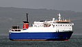 'Stena Seafarer' off Bangor - geograph.org.uk - 1314949.jpg 640 × 367; 230 KB
-
 Ardglass (1), May 2009.JPG 3,072 × 2,304; 2.77 MB
-
 Ardglass (2), May 2009.JPG 3,072 × 2,304; 2.74 MB
-
 Ballydown (Young) Farmers Hall - geograph.org.uk - 1311596.jpg 640 × 369; 68 KB
-
 Ballydown crossroads, Banbridge - geograph.org.uk - 1311478.jpg 640 × 350; 78 KB
-
 Bangor Marina - geograph.org.uk - 1334282.jpg 640 × 503; 393 KB
-
 Belfast Lough sunset - geograph.org.uk - 1334295.jpg 640 × 445; 210 KB
-
 Breens Lane, Downpatrick - geograph.org.uk - 1290293.jpg 617 × 332; 112 KB
-
 Castle Street, Portaferry - geograph.org.uk - 1299416.jpg 640 × 378; 62 KB
-
 Comber fire station - geograph.org.uk - 1296563.jpg 640 × 352; 60 KB
-
 Crossroads near Downpatrick - geograph.org.uk - 1310117.jpg 640 × 385; 86 KB
-
 Cuan Beach, Killyleagh - geograph.org.uk - 1309680.jpg 640 × 314; 62 KB
-
 Ferry information sign near Downpatrick - geograph.org.uk - 1310001.jpg 567 × 445; 102 KB
-
 Irish Street, Killyleagh - geograph.org.uk - 1309616.jpg 640 × 358; 57 KB
-
 New Bridge Street, Downpatrick - geograph.org.uk - 1290053.jpg 618 × 424; 89 KB
-
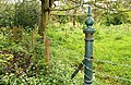 Old post near Edenderry, Belfast - geograph.org.uk - 1288649.jpg 640 × 415; 131 KB
-
 Old railway bridge, Banbridge - geograph.org.uk - 1311512.jpg 640 × 397; 127 KB
-
 Old railway fence, Banbridge - geograph.org.uk - 1311534.jpg 607 × 391; 123 KB
-
 Old steps near Downpatrick - geograph.org.uk - 1310153.jpg 580 × 393; 118 KB
-
 Pillar box, Edenderry near Belfast - geograph.org.uk - 1288948.jpg 640 × 416; 97 KB
-
 River Bann at Ballycoshone - geograph.org.uk - 1319693.jpg 640 × 426; 118 KB
-

-
 Seaview, Killyleagh - geograph.org.uk - 1309643.jpg 640 × 356; 74 KB
-
 Shore Street, Killyleagh - geograph.org.uk - 1309662.jpg 640 × 396; 71 KB
-
 The 'Immanuel VII' at Bangor - geograph.org.uk - 1315210.jpg 640 × 518; 444 KB
-
 The 'Karima' at Bangor - geograph.org.uk - 1338233.jpg 640 × 481; 294 KB
-
 The Belfast Road, Downpatrick - geograph.org.uk - 1290231.jpg 640 × 365; 88 KB
-
 The Castlewellan Road, Banbridge (1) - geograph.org.uk - 1311053.jpg 640 × 357; 75 KB
-
 The Castlewellan Road, Banbridge (2) - geograph.org.uk - 1311072.jpg 640 × 392; 75 KB
-
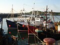
 Two fishing boats at Bangor - geograph.org.uk - 1325784.jpg 640 × 512; 379 KB


,_May_2009.JPG)
,_May_2009.JPG)
_Farmers_Hall_-_geograph.org.uk_-_1311596.jpg)


_-_geograph.org.uk_-_1311053.jpg)
_-_geograph.org.uk_-_1311072.jpg)
